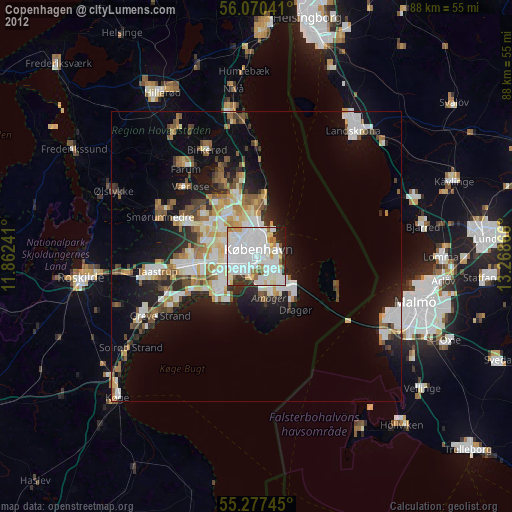
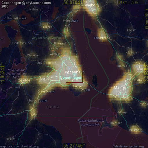
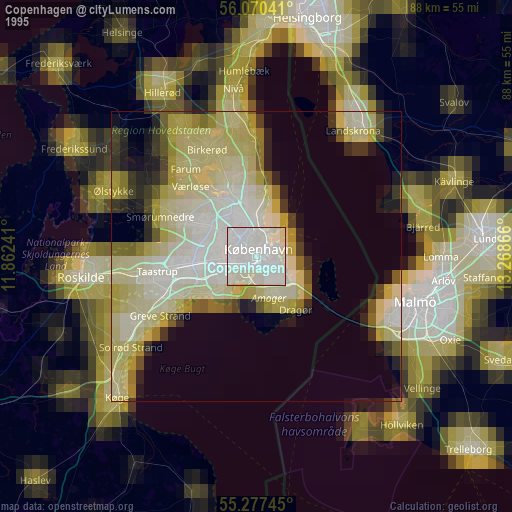
Copenhagen night lights from space
Night Light of Copenhagen (Capital Region) from space (Denmark) Src. Average luminocity for 10x10km area is 88.9653% and for 50x50km: 22.8214%.
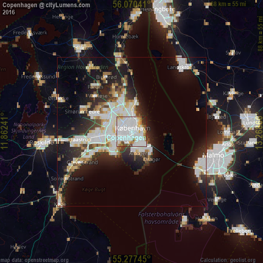
Analysis of Copenhagen night lights 2016
Square area 10x10 km:
 48.56%
90-99
25.96%80-89
5.38%70-79
3.95%60-69
4.43%50-59
3.35%40-49
3.23%30-39
1.67%20-29
2.99%10-19
0.48%0-9
0%Square area 50x50 km:
6.17%90-99
5.65%80-89
2.13%70-79
1.75%60-69
1.93%50-59
1.81%40-49
1.94%30-39
2.55%20-29
5.58%10-19
13.05%0-9
57.44%Clear (daylight) street map image can be seen on geolist.org.
Map coordinates:
56° 4' 13.5" North, 11° 51' 44.7" East
55° 40' 33.4" North, 12° 33' 55.9" East
55° 16' 38.8" North, 13° 16' 7.2" East
Some cities around Copenhagen sort by population:
• Frederiksberg
2 km =1.2 mi,  281°
281°
• Hvidovre
6.1 km =3.8 mi,  250°
250°
• Charlottenlund
8.5 km =5.3 mi,  3°
3°
• Vanløse
5 km =3.1 mi, 279°
• Rødovre
7 km =4.3 mi,  274°
274°
• Glostrup
10.2 km =6.3 mi,  264°
264°
• Christianshavn
1.9 km =1.2 mi,  97°
97°
• Tårnby
5.5 km =3.4 mi,  156°
156°
2618425 (p: 1,153,615)
Sources (retrieved 2019-11-25):
» NASA, Earths city lights 1995
» NASA city lights 2003
» Earth at Night: Flat Maps 2012, 2016