Charlottenlund night lights from space
Night Light of Charlottenlund (Capital Region) from space (Denmark) Src. Average luminocity for 10x10km area is 58.9916% and for 50x50km: 24.048%.
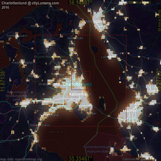
Analysis of Charlottenlund night lights 2016
Square area 10x10 km:
 18.54%
90-99
18.9%80-89
8.61%70-79
2.75%60-69
3.59%50-59
5.02%40-49
1.32%30-39
7.06%20-29
10.41%10-19
12.08%0-9
11.72%Square area 50x50 km:
6.41%90-99
5.76%80-89
2.35%70-79
1.86%60-69
1.99%50-59
1.89%40-49
2.08%30-39
2.54%20-29
5.69%10-19
14.84%0-9
54.6%Clear (daylight) street map image can be seen on geolist.org.
Map coordinates:
56° 8' 45.9" North, 11° 52' 17" East
55° 45' 8.6" North, 12° 34' 28.2" East
55° 21' 16.8" North, 13° 16' 39.5" East
Some cities around Charlottenlund sort by population:
• Copenhagen
8.5 km =5.3 mi,  183°
183°
• Frederiksberg
8.5 km =5.3 mi,  197°
197°
• Hvidovre
12.3 km =7.6 mi,  210°
210°
• Vanløse
9.4 km =5.8 mi,  215°
215°
• Rødovre
11 km =6.8 mi, 223°
• Kongens Lyngby
4.9 km =3 mi,  294°
294°
• Christianshavn
8.8 km =5.5 mi,  171°
171°
• Trørød
9.9 km =6.2 mi,  348°
348°
2623188 (p: 40,000)
Sources (retrieved 2019-11-25):
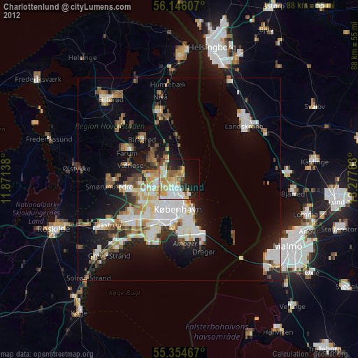
» Earth at Night: Flat Maps 2012, 2016