Vanløse night lights from space
Night Light of Vanløse (Capital Region) from space (Denmark) Src. Average luminocity for 10x10km area is 95.8481% and for 50x50km: 22.5985%.
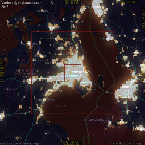
Analysis of Vanløse night lights 2016
Square area 10x10 km:
 49.52%
90-99
36.12%80-89
7.54%70-79
5.5%60-69
0.36%50-59
0.24%40-49
0.72%30-39
0%20-29
0%10-19
0%0-9
0%Square area 50x50 km:
5.98%90-99
5.45%80-89
2.14%70-79
1.79%60-69
1.92%50-59
1.94%40-49
1.99%30-39
2.36%20-29
5.15%10-19
13.86%0-9
57.42%Clear (daylight) street map image can be seen on geolist.org.
Map coordinates:
56° 4' 40.8" North, 11° 47' 2.4" East
55° 41' 1" North, 12° 29' 13.7" East
55° 17' 6.7" North, 13° 11' 24.9" East
Some cities around Vanløse sort by population:
• Copenhagen
5 km =3.1 mi,  99°
99°
• Frederiksberg
3 km =1.9 mi, 98°
• Hvidovre
3.1 km =1.9 mi,  196°
196°
• Albertslund
8.3 km =5.2 mi,  248°
248°
• Rødovre
2.1 km =1.3 mi,  260°
260°
• Glostrup
5.6 km =3.5 mi, 250°
• Christianshavn
6.9 km =4.3 mi, 99°
• Tårnby
9.3 km =5.8 mi,  129°
129°
2610734 (p: 37,115)
Sources (retrieved 2019-11-25):
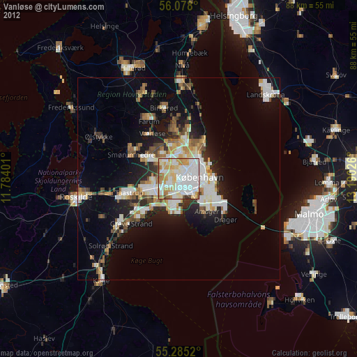
» Earth at Night: Flat Maps 2012, 2016