Nörvenich night lights from space
Night Light of Nörvenich (North Rhine-Westphalia) from space (Germany) Src. Average luminocity for 10x10km area is 3.8263% and for 50x50km: 20.3623%.
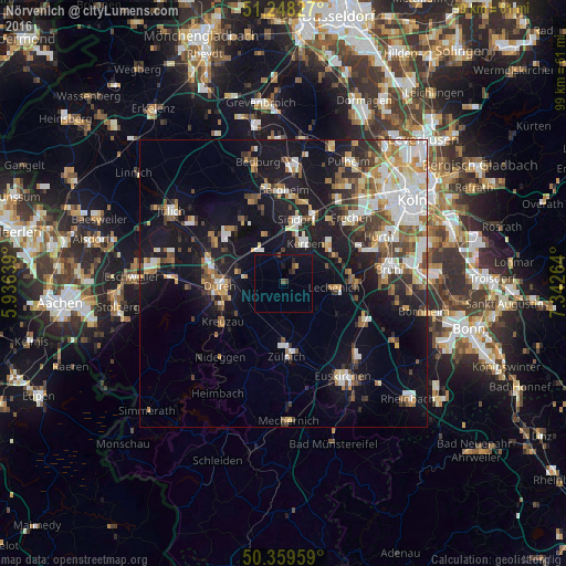
Analysis of Nörvenich night lights 2016
Square area 10x10 km:
 0%
0%90-99
0%80-89
0%70-79
0.56%60-69
0%50-59
1.12%40-49
0.28%30-39
1.12%20-29
1.26%10-19
3.36%0-9
92.3%Square area 50x50 km:
3.88%90-99
3.97%80-89
1.74%70-79
2.11%60-69
2.67%50-59
2.47%40-49
2.79%30-39
2.34%20-29
4%10-19
16.05%0-9
58%Clear (daylight) street map image can be seen on geolist.org.
Map coordinates:
51° 14' 53.8" North, 5° 56' 11" East
50° 48' 21.7" North, 6° 38' 22.3" East
50° 21' 34.5" North, 7° 20' 33.5" East
Some cities around Nörvenich sort by population:
• Düren
10.3 km =6.4 mi,  268°
268°
• Kerpen
8.2 km =5.1 mi,  29°
29°
• Erftstadt
10.9 km =6.8 mi,  84°
84°
• Elsdorf
15.4 km =9.6 mi,  341°
341°
• Zulpich
12.4 km =7.7 mi,  175°
175°
• Kreuzau
12.4 km =7.7 mi,  237°
237°
• Niederzier
14.9 km =9.3 mi,  305°
305°
• Vettweiß
8.5 km =5.3 mi,  198°
198°
2861801 (p: 11,481)
Sources (retrieved 2019-11-25):
» Earth at Night: Flat Maps 2012, 2016