Mechernich night lights from space
Night Light of Mechernich (North Rhine-Westphalia) from space (Germany) Src. Average luminocity for 10x10km area is 2.4144% and for 50x50km: 4.49%.
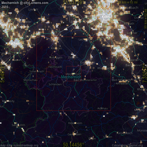
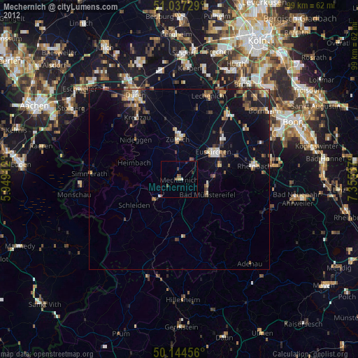
Analysis of Mechernich night lights 2016
Square area 10x10 km:
 0%
0%90-99
0%80-89
0.53%70-79
0.53%60-69
0%50-59
0.53%40-49
0.4%30-39
1.74%20-29
0.13%10-19
0.94%0-9
95.19%Square area 50x50 km:
0.36%90-99
0.44%80-89
0.33%70-79
0.48%60-69
0.68%50-59
0.76%40-49
0.65%30-39
0.71%20-29
1.27%10-19
4.18%0-9
90.14%Clear (daylight) street map image can be seen on geolist.org.
Map coordinates:
51° 2' 14.2" North, 5° 56' 56.8" East
50° 35' 34.9" North, 6° 39' 8.1" East
50° 8' 40.4" North, 7° 21' 19.3" East
Some cities around Mechernich sort by population:
• Euskirchen
12.1 km =7.5 mi,  51°
51°
• Zulpich
11.3 km =7 mi,  0°
0°
• Bad Münstereifel
8.9 km =5.5 mi,  117°
117°
• Schleiden
14.3 km =8.9 mi,  240°
240°
• Kall
8.5 km =5.3 mi,  228°
228°
• Nideggen
16.2 km =10.1 mi,  313°
313°
• Vettweiß
16 km =9.9 mi,  346°
346°
• Nettersheim
11.2 km =7 mi,  188°
188°
2872611 (p: 27,537)
Sources (retrieved 2019-11-25):
» Earth at Night: Flat Maps 2012, 2016