Wilmersdorf night lights from space
Night Light of Wilmersdorf (Berlin) from space (Germany) Src. Average luminocity for 10x10km area is 93.1919% and for 50x50km: 38.4589%.
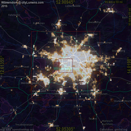
Analysis of Wilmersdorf night lights 2016
Square area 10x10 km:
 52.9%
52.9%90-99
31.69%80-89
5.3%70-79
0.76%60-69
1.52%50-59
0.76%40-49
5.56%30-39
1.52%20-29
0%10-19
0%0-9
0%Square area 50x50 km:
11.09%90-99
9.6%80-89
3.69%70-79
3.01%60-69
3.25%50-59
3.47%40-49
3.97%30-39
4.24%20-29
8.76%10-19
16.15%0-9
32.77%Clear (daylight) street map image can be seen on geolist.org.
Map coordinates:
52° 54' 34" North, 12° 36' 48.8" East
52° 28' 60" North, 13° 19' 0" East
52° 3' 11" North, 14° 1' 11.3" East
Some cities around Wilmersdorf sort by population:
• Schöneberg
2.9 km =1.8 mi,  129°
129°
• Steglitz
3.2 km =2 mi,  161°
161°
• Friedenau
1.5 km =0.9 mi,  149°
149°
• Schmargendorf
2 km =1.2 mi,  242°
242°
• Dahlem
3.5 km =2.2 mi,  215°
215°
• Halensee
1.6 km =1 mi,  298°
298°
• Grunewald
3.4 km =2.1 mi,  270°
270°
• Hansaviertel
4.3 km =2.7 mi,  23°
23°
2808473 (p: 94,113)
Sources (retrieved 2019-11-25):
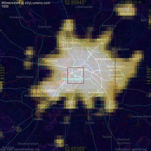
» NASA, Earths city lights 1995
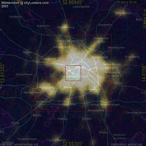
» NASA city lights 2003
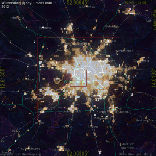
» Earth at Night: Flat Maps 2012, 2016