Steglitz night lights from space
Night Light of Steglitz (Berlin) from space (Germany) Src. Average luminocity for 10x10km area is 94.4066% and for 50x50km: 38.3725%.
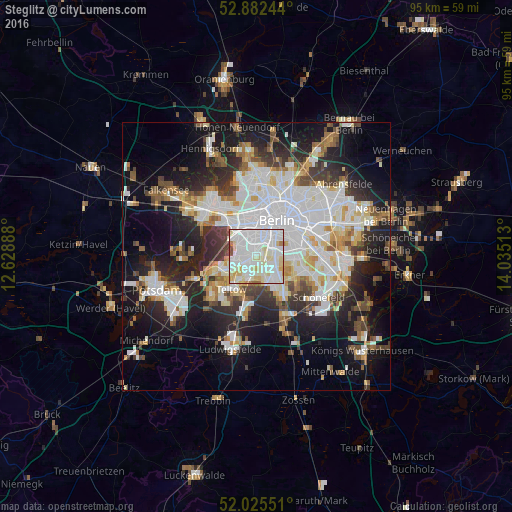
Analysis of Steglitz night lights 2016
Square area 10x10 km:
 42.17%
90-99
39.02%80-89
12.37%70-79
2.02%60-69
1.77%50-59
1.39%40-49
1.26%30-39
0%20-29
0%10-19
0%0-9
0%Square area 50x50 km:
11.09%90-99
9.57%80-89
3.69%70-79
2.98%60-69
3.24%50-59
3.53%40-49
4%30-39
4.34%20-29
8.74%10-19
15.97%0-9
32.84%Clear (daylight) street map image can be seen on geolist.org.
Map coordinates:
52° 52' 56.8" North, 12° 37' 44" East
52° 27' 21.8" North, 13° 19' 55.2" East
52° 1' 31.8" North, 14° 2' 6.5" East
Some cities around Steglitz sort by population:
• Schöneberg
1.7 km =1.1 mi,  45°
45°
• Wilmersdorf
3.2 km =2 mi,  341°
341°
• Lichterfelde
3 km =1.9 mi,  213°
213°
• Mariendorf
3.9 km =2.4 mi,  121°
121°
• Lankwitz
2.4 km =1.5 mi,  156°
156°
• Friedenau
1.7 km =1.1 mi,  351°
351°
• Schmargendorf
3.5 km =2.2 mi,  307°
307°
• Dahlem
3.1 km =1.9 mi,  274°
274°
2829109 (p: 72,464)
Sources (retrieved 2019-11-25):
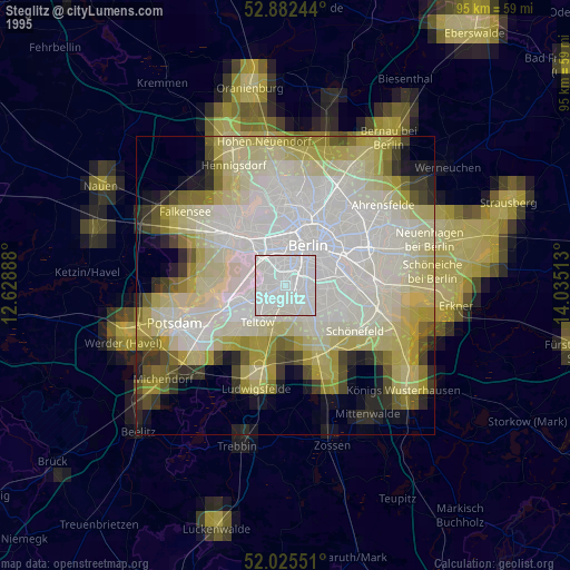
» NASA, Earths city lights 1995
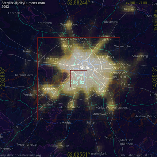
» NASA city lights 2003
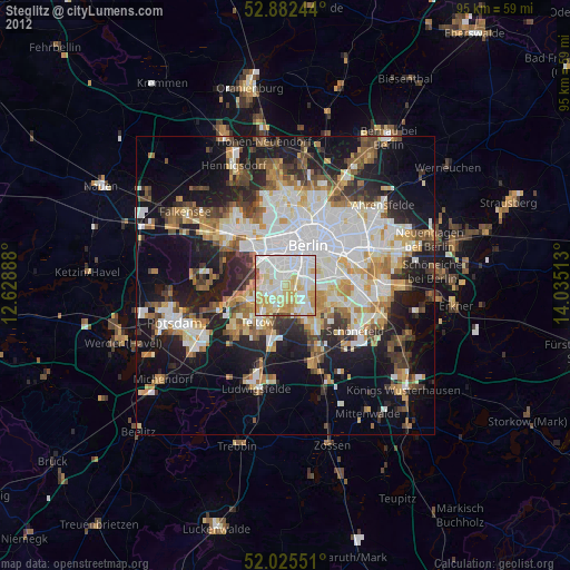
» Earth at Night: Flat Maps 2012, 2016