Halensee night lights from space
Night Light of Halensee (Berlin) from space (Germany) Src. Average luminocity for 10x10km area is 87.1894% and for 50x50km: 38.2664%.
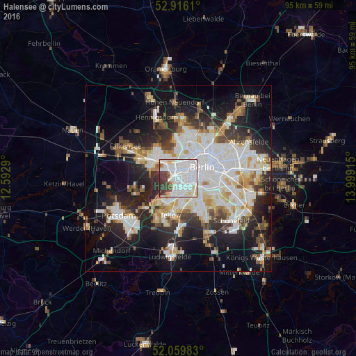
Analysis of Halensee night lights 2016
Square area 10x10 km:
 48.61%
90-99
26.14%80-89
4.92%70-79
1.26%60-69
2.15%50-59
1.01%40-49
6.06%30-39
9.22%20-29
0.63%10-19
0%0-9
0%Square area 50x50 km:
11.09%90-99
9.6%80-89
3.7%70-79
2.99%60-69
3.22%50-59
3.45%40-49
3.9%30-39
4.21%20-29
8.71%10-19
15.55%0-9
33.58%Clear (daylight) street map image can be seen on geolist.org.
Map coordinates:
52° 54' 58" North, 12° 35' 34.4" East
52° 29' 24.2" North, 13° 17' 45.7" East
52° 3' 35.4" North, 13° 59' 56.9" East
Some cities around Halensee sort by population:
• Charlottenburg
3.1 km =1.9 mi,  343°
343°
• Wilmersdorf
1.6 km =1 mi,  118°
118°
• Westend
3.3 km =2.1 mi, 336°
• Friedenau
3 km =1.9 mi,  133°
133°
• Schmargendorf
1.7 km =1.1 mi,  192°
192°
• Dahlem
3.6 km =2.2 mi, 189°
• Grunewald
2.2 km =1.4 mi,  250°
250°
• Hansaviertel
4.4 km =2.7 mi,  44°
44°
2911559 (p: 12,605)
Sources (retrieved 2019-11-25):
» Earth at Night: Flat Maps 2012, 2016