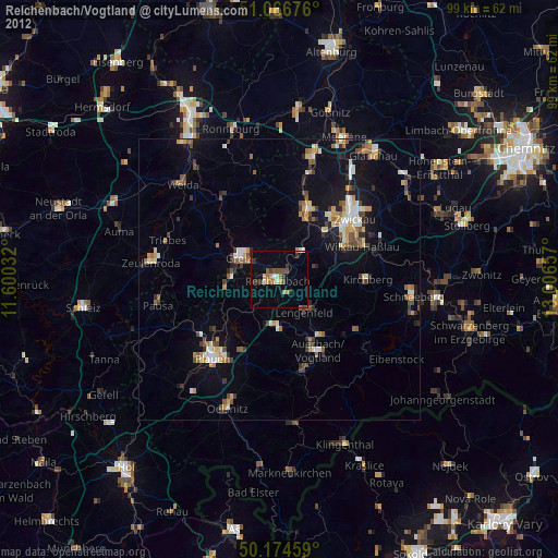
Reichenbach/Vogtland night lights from space
Night Light of Reichenbach/Vogtland (Saxony) from space (Germany) Src. Average luminocity for 10x10km area is 8.2794% and for 50x50km: 5.7837%.
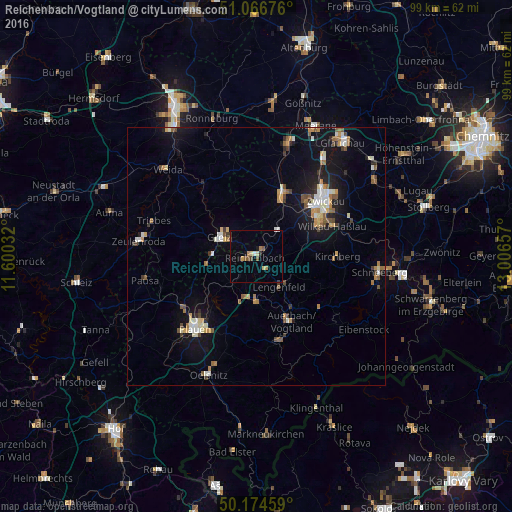
Analysis of Reichenbach/Vogtland night lights 2016
Square area 10x10 km:
 0.4%
0.4%90-99
0.67%80-89
1.6%70-79
1.47%60-69
0.67%50-59
1.87%40-49
0.53%30-39
1.2%20-29
0.4%10-19
1.6%0-9
89.57%Square area 50x50 km:
0.64%90-99
0.89%80-89
0.55%70-79
0.83%60-69
0.75%50-59
0.89%40-49
0.58%30-39
0.56%20-29
0.74%10-19
4.77%0-9
88.81%Clear (daylight) street map image can be seen on geolist.org.
Map coordinates:
51° 4' 0.3" North, 11° 36' 1.2" East
50° 37' 22" North, 12° 18' 12.4" East
50° 10' 28.5" North, 13° 0' 23.7" East
Some cities around Reichenbach/Vogtland sort by population:
• Werdau
13.6 km =8.5 mi,  21°
21°
• Greiz
8.3 km =5.2 mi,  297°
297°
• Treuen
8.9 km =5.5 mi,  180°
180°
• Lengenfeld
7.3 km =4.5 mi,  144°
144°
• Rodewisch
12.8 km =8 mi, 142°
• Lichtentanne
11.6 km =7.2 mi,  48°
48°
• Fraureuth
9.2 km =5.7 mi, 20°
• Elsterberg
9.7 km =6 mi,  260°
260°
2849156 (p: 22,530)
Sources (retrieved 2019-11-25):
» Earth at Night: Flat Maps 2012, 2016