Wandlitz night lights from space
Night Light of Wandlitz (Brandenburg) from space (Germany) Src. Average luminocity for 10x10km area is 1.8157% and for 50x50km: 16.1018%.
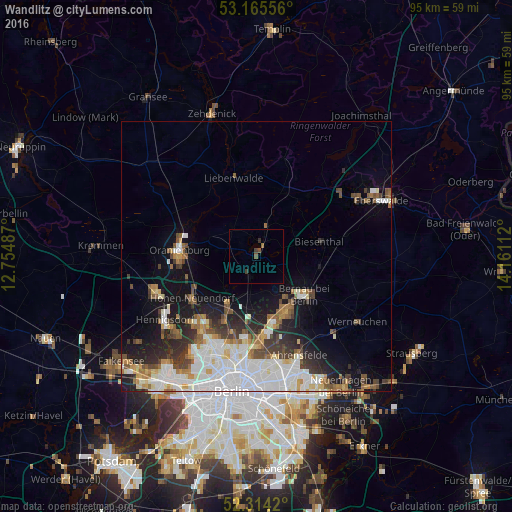
Analysis of Wandlitz night lights 2016
Square area 10x10 km:
 0%
0%90-99
0%80-89
0%70-79
0%60-69
0.38%50-59
0.38%40-49
0.88%30-39
1.26%20-29
0.13%10-19
0%0-9
96.97%Square area 50x50 km:
4.6%90-99
3.79%80-89
1.23%70-79
1.13%60-69
1.57%50-59
1.83%40-49
2.02%30-39
2.01%20-29
2.96%10-19
6.83%0-9
72.02%Clear (daylight) street map image can be seen on geolist.org.
Map coordinates:
53° 9' 56" North, 12° 45' 17.5" East
52° 44' 31.1" North, 13° 27' 28.8" East
52° 18' 51.1" North, 14° 9' 40" East
Some cities around Wandlitz sort by population:
• Oranienburg
14.6 km =9.1 mi,  276°
276°
• Bernau bei Berlin
11.1 km =6.9 mi,  128°
128°
• Hohen Neuendorf
14.2 km =8.8 mi,  238°
238°
• Karow
14.9 km =9.3 mi,  173°
173°
• Buch
12.2 km =7.6 mi, 167°
• Glienicke
15 km =9.3 mi,  216°
216°
• Birkenwerder
13.4 km =8.3 mi, 244°
• Biesenthal
12.8 km =8 mi,  77°
77°
2814305 (p: 19,888)
Sources (retrieved 2019-11-25):
» Earth at Night: Flat Maps 2012, 2016