Waibstadt night lights from space
Night Light of Waibstadt (Baden-Württemberg) from space (Germany) Src. Average luminocity for 10x10km area is 6.4265% and for 50x50km: 12.0374%.
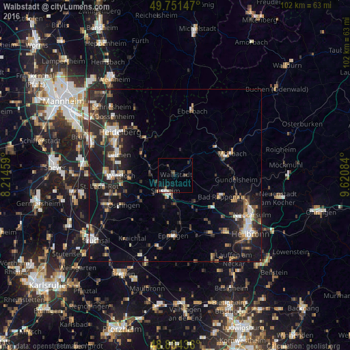
Analysis of Waibstadt night lights 2016
Square area 10x10 km:
 0.67%
0.67%90-99
1.47%80-89
0%70-79
0.27%60-69
0.53%50-59
0.53%40-49
1.47%30-39
3.21%20-29
0.67%10-19
0.67%0-9
90.51%Square area 50x50 km:
1.47%90-99
1.67%80-89
0.98%70-79
1.02%60-69
1.56%50-59
1.89%40-49
1.61%30-39
2.09%20-29
5.25%10-19
10.16%0-9
72.31%Clear (daylight) street map image can be seen on geolist.org.
Map coordinates:
49° 45' 5.3" North, 8° 12' 52.5" East
49° 17' 42.2" North, 8° 55' 3.8" East
48° 50' 3.7" North, 9° 37' 15" East
Some cities around Waibstadt sort by population:
• Sinsheim
5.5 km =3.4 mi,  211°
211°
• Bad Rappenau
14.8 km =9.2 mi,  115°
115°
• Neckargemünd
13.7 km =8.5 mi,  319°
319°
• Dielheim
13.1 km =8.1 mi,  264°
264°
• Bammental
12.1 km =7.5 mi,  304°
304°
• Kirchardt
11.4 km =7.1 mi,  151°
151°
• Meckesheim
7.7 km =4.8 mi,  292°
292°
• Obrigheim
14.1 km =8.8 mi,  63°
63°
2815328 (p: 5,762)
Sources (retrieved 2019-11-25):
» Earth at Night: Flat Maps 2012, 2016