Bammental night lights from space
Night Light of Bammental (Baden-Württemberg) from space (Germany) Src. Average luminocity for 10x10km area is 7.1203% and for 50x50km: 17.8038%.
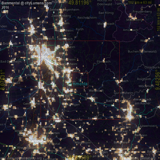
Analysis of Bammental night lights 2016
Square area 10x10 km:
 0%
0%90-99
0%80-89
0.53%70-79
0%60-69
0.53%50-59
1.6%40-49
0%30-39
1.2%20-29
3.48%10-19
18.98%0-9
73.66%Square area 50x50 km:
3.3%90-99
3.65%80-89
1.54%70-79
1.33%60-69
1.77%50-59
1.91%40-49
2.07%30-39
2.86%20-29
6.97%10-19
13.91%0-9
60.69%Clear (daylight) street map image can be seen on geolist.org.
Map coordinates:
49° 48' 43.1" North, 8° 4' 34.7" East
49° 21' 22" North, 8° 46' 46" East
48° 53' 45.6" North, 9° 28' 57.2" East
Some cities around Bammental sort by population:
• Heidelberg
8.6 km =5.3 mi,  311°
311°
• Leimen
6.7 km =4.2 mi,  261°
261°
• Wiesloch
9 km =5.6 mi,  220°
220°
• Sandhausen
8.8 km =5.5 mi, 260°
• Neckargemünd
3.8 km =2.4 mi,  18°
18°
• Nußloch
7.1 km =4.4 mi,  239°
239°
• Dielheim
8.5 km =5.3 mi,  200°
200°
• Meckesheim
4.8 km =3 mi,  142°
142°
2952973 (p: 6,493)
Sources (retrieved 2019-11-25):
» Earth at Night: Flat Maps 2012, 2016