Sonsbeck night lights from space
Night Light of Sonsbeck (North Rhine-Westphalia) from space (Germany) Src. Average luminocity for 10x10km area is 0.5615% and for 50x50km: 12.6469%.
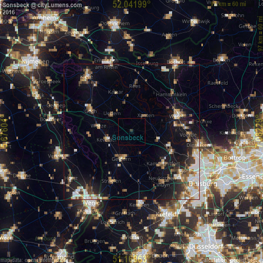
Analysis of Sonsbeck night lights 2016
Square area 10x10 km:
 0%
0%90-99
0%80-89
0%70-79
0%60-69
0%50-59
0%40-49
0%30-39
0.53%20-29
0.8%10-19
0%0-9
98.66%Square area 50x50 km:
1.89%90-99
1.92%80-89
1.26%70-79
1.24%60-69
1.19%50-59
2.11%40-49
2.18%30-39
1.63%20-29
2.62%10-19
9.54%0-9
74.42%Clear (daylight) street map image can be seen on geolist.org.
Map coordinates:
52° 2' 31.2" North, 5° 40' 33.7" East
51° 36' 26.7" North, 6° 22' 45" East
51° 10' 7.1" North, 7° 4' 56.2" East
Some cities around Sonsbeck sort by population:
• Geldern
10.5 km =6.5 mi,  201°
201°
• Kevelaer
9.6 km =6 mi,  253°
253°
• Xanten
7.7 km =4.8 mi,  41°
41°
• Kalkar
15.9 km =9.9 mi,  337°
337°
• Alpen
9.9 km =6.2 mi,  105°
105°
• Issum
9 km =5.6 mi,  155°
155°
• Weeze
12.7 km =7.9 mi,  279°
279°
• Uedem
9.7 km =6 mi,  311°
311°
2831105 (p: 8,604)
Sources (retrieved 2019-11-25):
» Earth at Night: Flat Maps 2012, 2016