Kalkar night lights from space
Night Light of Kalkar (North Rhine-Westphalia) from space (Germany) Src. Average luminocity for 10x10km area is 2.5518% and for 50x50km: 10.3154%.
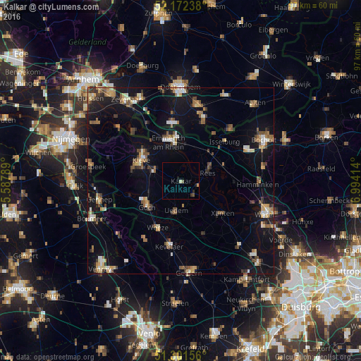
Analysis of Kalkar night lights 2016
Square area 10x10 km:
 0%
0%90-99
0%80-89
0.56%70-79
0.56%60-69
0%50-59
0.98%40-49
0.14%30-39
0.56%20-29
0.56%10-19
1.12%0-9
95.52%Square area 50x50 km:
0.85%90-99
1.21%80-89
1.22%70-79
1.14%60-69
1.46%50-59
1.83%40-49
1.46%30-39
1.2%20-29
1.61%10-19
9.15%0-9
78.88%Clear (daylight) street map image can be seen on geolist.org.
Map coordinates:
52° 10' 20.6" North, 5° 35' 16.4" East
51° 44' 20.7" North, 6° 17' 27.6" East
51° 18' 5.6" North, 6° 59' 38.9" East
Some cities around Kalkar sort by population:
• Kleve
11.8 km =7.3 mi,  297°
297°
• Goch
11.3 km =7 mi,  233°
233°
• Emmerich
11.5 km =7.1 mi,  345°
345°
• Rees
7.8 km =4.8 mi,  70°
70°
• Xanten
14.3 km =8.9 mi,  128°
128°
• Weeze
14 km =8.7 mi,  207°
207°
• Uedem
8.3 km =5.2 mi,  188°
188°
• Mehrhoog
15.2 km =9.4 mi,  90°
90°
2893837 (p: 13,997)
Sources (retrieved 2019-11-25):
» Earth at Night: Flat Maps 2012, 2016