Geldern night lights from space
Night Light of Geldern (North Rhine-Westphalia) from space (Germany) Src. Average luminocity for 10x10km area is 9.6203% and for 50x50km: 15.5267%.
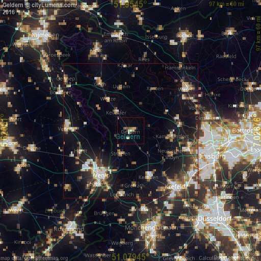
Analysis of Geldern night lights 2016
Square area 10x10 km:
 0.27%
0.27%90-99
1.87%80-89
1.87%70-79
1.34%60-69
1.07%50-59
1.07%40-49
1.2%30-39
0.94%20-29
0.13%10-19
1.74%0-9
88.5%Square area 50x50 km:
2.06%90-99
2.18%80-89
1.42%70-79
1.64%60-69
1.54%50-59
2.81%40-49
2.89%30-39
2.5%20-29
4.05%10-19
11.95%0-9
66.95%Clear (daylight) street map image can be seen on geolist.org.
Map coordinates:
51° 57' 16.2" North, 5° 37' 13.8" East
51° 31' 8.7" North, 6° 19' 25.1" East
51° 4' 46" North, 7° 1' 36.3" East
Some cities around Geldern sort by population:
• Kevelaer
8.9 km =5.5 mi,  322°
322°
• Straelen
9.5 km =5.9 mi,  204°
204°
• Issum
7.8 km =4.8 mi,  78°
78°
• Weeze
14.8 km =9.2 mi, 324°
• Arcen, NL
11 km =6.8 mi,  244°
244°
• Sonsbeck
10.5 km =6.5 mi,  21°
21°
• Wachtendonk
12.3 km =7.6 mi,  175°
175°
• Rheurdt
11.5 km =7.1 mi,  120°
120°
2921528 (p: 34,013)
Sources (retrieved 2019-11-25):
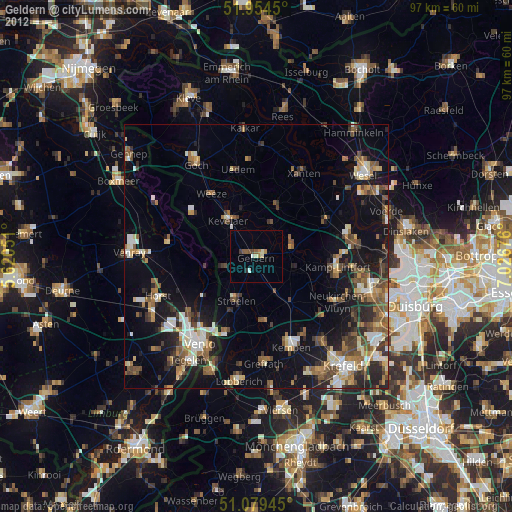
» Earth at Night: Flat Maps 2012, 2016