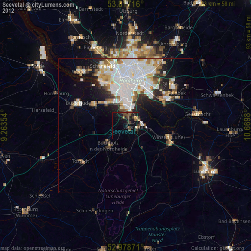
Seevetal night lights from space
Night Light of Seevetal (Lower Saxony) from space (Germany) Src. Average luminocity for 10x10km area is 15.4339% and for 50x50km: 17.8598%.
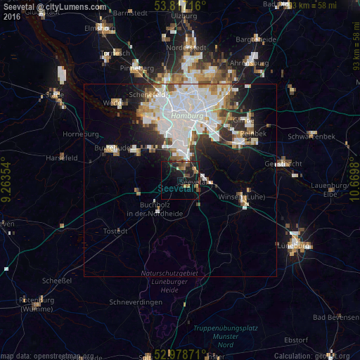
Analysis of Seevetal night lights 2016
Square area 10x10 km:
 0.26%
0.26%90-99
0.4%80-89
0.13%70-79
2.78%60-69
2.12%50-59
4.37%40-49
4.23%30-39
0.66%20-29
7.41%10-19
24.47%0-9
53.17%Square area 50x50 km:
6.38%90-99
4.28%80-89
1.1%70-79
1.36%60-69
1.66%50-59
1.49%40-49
1.27%30-39
1.51%20-29
3.21%10-19
5.72%0-9
72%Clear (daylight) street map image can be seen on geolist.org.
Map coordinates:
53° 49' 1.8" North, 9° 15' 48.7" East
53° 24' 0" North, 9° 58' 0" East
52° 58' 43.4" North, 10° 40' 11.3" East
Some cities around Seevetal sort by population:
• Altona
16.8 km =10.4 mi,  352°
352°
• Harburg
6.8 km =4.2 mi,  9°
9°
• Buchholz in der Nordheide
10.5 km =6.5 mi,  218°
218°
• Neu Wulmstorf
13.3 km =8.3 mi,  303°
303°
• Neustadt
16.9 km =10.5 mi,  4°
4°
• Stelle
9.8 km =6.1 mi,  100°
100°
• Rothenburgsort
15.8 km =9.8 mi,  18°
18°
• Jesteburg
10.1 km =6.3 mi,  185°
185°
2833564 (p: 41,266)
Sources (retrieved 2019-11-25):
» Earth at Night: Flat Maps 2012, 2016