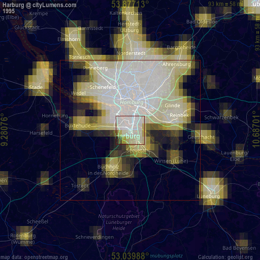
Harburg night lights from space
Night Light of Harburg (Hamburg) from space (Germany) Src. Average luminocity for 10x10km area is 54.5926% and for 50x50km: 22.5511%.
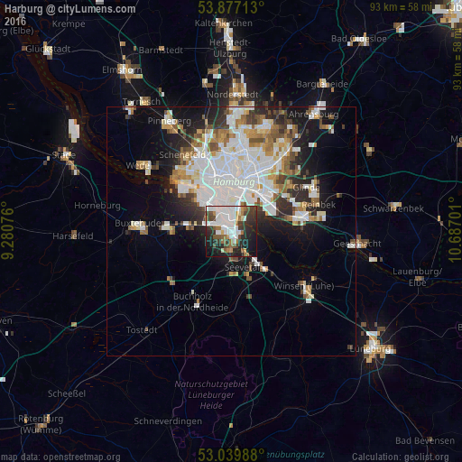
Analysis of Harburg night lights 2016
Square area 10x10 km:
 18.65%
90-99
11.51%80-89
1.46%70-79
3.7%60-69
6.88%50-59
5.42%40-49
7.8%30-39
9.92%20-29
17.06%10-19
16.14%0-9
1.46%Square area 50x50 km:
7.06%90-99
5.14%80-89
1.49%70-79
1.97%60-69
2.51%50-59
2.19%40-49
2.28%30-39
2.15%20-29
4.18%10-19
8.55%0-9
62.47%Clear (daylight) street map image can be seen on geolist.org.
Map coordinates:
53° 52' 37.7" North, 9° 16' 50.7" East
53° 27' 38.1" North, 9° 59' 2" East
53° 2' 23.6" North, 10° 41' 13.2" East
Some cities around Harburg sort by population:
• Altona
10.5 km =6.5 mi,  341°
341°
• Hamburg-Mitte
10.2 km =6.3 mi,  12°
12°
• Seevetal
6.8 km =4.2 mi,  189°
189°
• Ottensen
10.9 km =6.8 mi, 335°
• St. Pauli
10.8 km =6.7 mi,  353°
353°
• St. Georg
10.7 km =6.6 mi, 10°
• Neustadt
10.2 km =6.3 mi,  0°
0°
• Rothenburgsort
9.1 km =5.7 mi,  24°
24°
2910685 (p: 202,571)
Sources (retrieved 2019-11-25):
» NASA, Earths city lights 1995
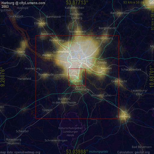
» NASA city lights 2003
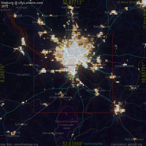
» Earth at Night: Flat Maps 2012, 2016