Buchholz in der Nordheide night lights from space
Night Light of Buchholz in der Nordheide (Lower Saxony) from space (Germany) Src. Average luminocity for 10x10km area is 2.9154% and for 50x50km: 10.1942%.
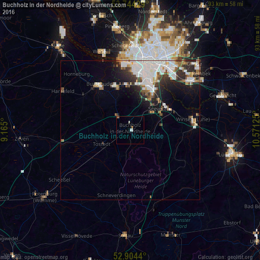
Analysis of Buchholz in der Nordheide night lights 2016
Square area 10x10 km:
 0.38%
0.38%90-99
1.14%80-89
0%70-79
0%60-69
1.52%50-59
0%40-49
0%30-39
0%20-29
0%10-19
0.51%0-9
96.46%Square area 50x50 km:
3.55%90-99
2.17%80-89
0.41%70-79
0.68%60-69
0.96%50-59
0.97%40-49
0.9%30-39
1.21%20-29
2.52%10-19
3.81%0-9
82.83%Clear (daylight) street map image can be seen on geolist.org.
Map coordinates:
53° 44' 39.4" North, 9° 9' 54" East
53° 19' 35.1" North, 9° 52' 5.2" East
52° 54' 15.8" North, 10° 34' 16.5" East
Some cities around Buchholz in der Nordheide sort by population:
• Harburg
16.8 km =10.4 mi,  27°
27°
• Seevetal
10.5 km =6.5 mi,  38°
38°
• Buxtehude
19.8 km =12.3 mi,  322°
322°
• Winsen
23.1 km =14.4 mi,  81°
81°
• Neu Wulmstorf
16.2 km =10.1 mi,  343°
343°
• Tostedt
11.1 km =6.9 mi,  244°
244°
• Stelle
17.4 km =10.8 mi,  68°
68°
• Jesteburg
5.9 km =3.7 mi,  108°
108°
2942323 (p: 37,404)
Sources (retrieved 2019-11-25):
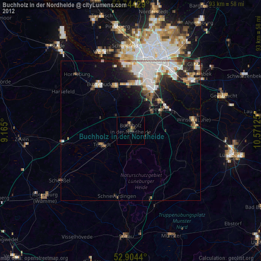
» Earth at Night: Flat Maps 2012, 2016