Schutterwald night lights from space
Night Light of Schutterwald (Baden-Württemberg) from space (Germany) Src. Average luminocity for 10x10km area is 21.1165% and for 50x50km: 17.8476%.
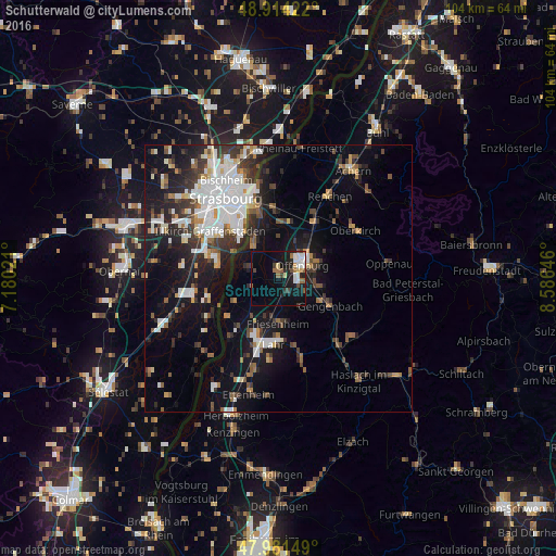
Analysis of Schutterwald night lights 2016
Square area 10x10 km:
 4.69%
4.69%90-99
2.98%80-89
2.13%70-79
0.85%60-69
2.84%50-59
2.27%40-49
2.84%30-39
2.27%20-29
2.98%10-19
19.46%0-9
56.68%Square area 50x50 km:
4.13%90-99
3.41%80-89
1.15%70-79
1.29%60-69
1.64%50-59
1.93%40-49
2.01%30-39
3.3%20-29
4.63%10-19
12.47%0-9
64.04%Clear (daylight) street map image can be seen on geolist.org.
Map coordinates:
48° 54' 51.2" North, 7° 10' 48.8" East
48° 27' 0" North, 7° 52' 60" East
47° 58' 53.4" North, 8° 35' 11.3" East
Some cities around Schutterwald sort by population:
• Offenburg
5.3 km =3.3 mi,  59°
59°
• Lahr
12.2 km =7.6 mi,  185°
185°
• Kehl
14.6 km =9.1 mi,  339°
339°
• Illkirch-Graffenstaden, FR
15.2 km =9.4 mi,  305°
305°
• Gengenbach
10.9 km =6.8 mi,  117°
117°
• Willstätt
10.1 km =6.3 mi,  4°
4°
• Hohberg
14.2 km =8.8 mi,  175°
175°
• Schwanau
12.9 km =8 mi,  223°
223°
2835596 (p: 7,105)
Sources (retrieved 2019-11-25):
» Earth at Night: Flat Maps 2012, 2016