Illkirch-Graffenstaden night lights from space
Night Light of Illkirch-Graffenstaden (Grand Est) from space (France) Src. Average luminocity for 10x10km area is 71.0341% and for 50x50km: 21.96%.
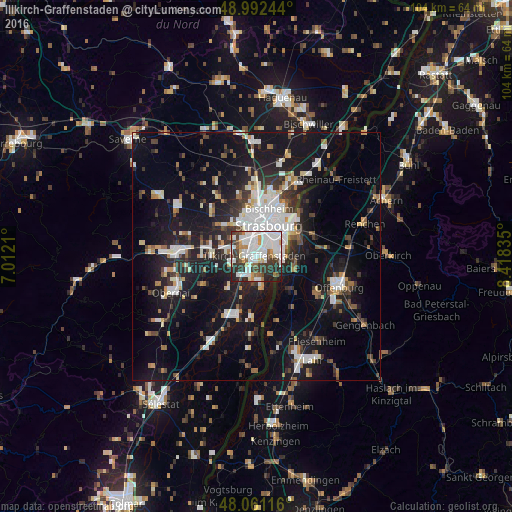
Analysis of Illkirch-Graffenstaden night lights 2016
Square area 10x10 km:
 26.42%
90-99
21.88%80-89
3.98%70-79
4.83%60-69
4.83%50-59
4.55%40-49
4.83%30-39
15.63%20-29
10.94%10-19
2.13%0-9
0%Square area 50x50 km:
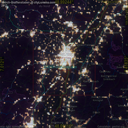
4.66%90-99
4.26%80-89
1.6%70-79
1.49%60-69
1.91%50-59
2.02%40-49
2.4%30-39
3.51%20-29
6.04%10-19
19.94%0-9
52.18%Clear (daylight) street map image can be seen on geolist.org.
Map coordinates:
48° 59' 32.8" North, 7° 0' 43.6" East
48° 31' 44.2" North, 7° 42' 54.8" East
48° 3' 40.2" North, 8° 25' 6.1" East
Some cities around Illkirch-Graffenstaden sort by population:
• Strasbourg
6.5 km =4 mi,  20°
20°
• Kehl, DE
8.8 km =5.5 mi,  56°
56°
• Schiltigheim
9.1 km =5.7 mi, 16°
• Bischheim
10.1 km =6.3 mi, 16°
• Lingolsheim
4 km =2.5 mi,  322°
322°
• Ostwald
1.7 km =1.1 mi,  349°
349°
• Geispolsheim
5.1 km =3.2 mi,  253°
253°
• Eckbolsheim
6.1 km =3.8 mi,  340°
340°
3012834 (p: 27,261)
Sources (retrieved 2019-11-25):
» Earth at Night: Flat Maps 2012, 2016