Gengenbach night lights from space
Night Light of Gengenbach (Baden-Württemberg) from space (Germany) Src. Average luminocity for 10x10km area is 6.1804% and for 50x50km: 12.2046%.
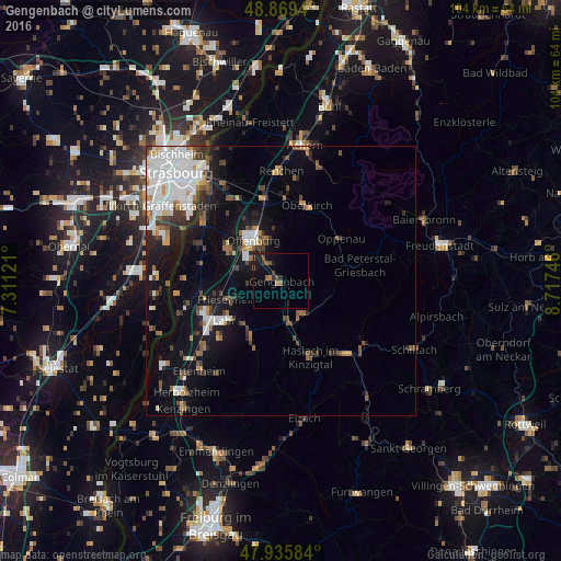
Analysis of Gengenbach night lights 2016
Square area 10x10 km:
 0%
0%90-99
0%80-89
0%70-79
0.43%60-69
1.14%50-59
2.41%40-49
1.42%30-39
0.85%20-29
1.99%10-19
6.82%0-9
84.94%Square area 50x50 km:
3.2%90-99
2.34%80-89
0.63%70-79
0.86%60-69
1.29%50-59
1.42%40-49
1.43%30-39
1.89%20-29
2.11%10-19
7.48%0-9
77.35%Clear (daylight) street map image can be seen on geolist.org.
Map coordinates:
48° 52' 9.8" North, 7° 18' 40.4" East
48° 24' 17.1" North, 8° 0' 51.6" East
47° 56' 9" North, 8° 43' 2.9" East
Some cities around Gengenbach sort by population:
• Offenburg
9.2 km =5.7 mi,  326°
326°
• Lahr
12.9 km =8 mi,  236°
236°
• Oberkirch
15 km =9.3 mi,  18°
18°
• Willstätt
17.6 km =10.9 mi, 329°
• Hohberg
12.4 km =7.7 mi,  222°
222°
• Schutterwald
10.9 km =6.8 mi,  297°
297°
• Hausach
18 km =11.2 mi,  138°
138°
• Seelbach
11.8 km =7.3 mi,  207°
207°
2921355 (p: 11,234)
Sources (retrieved 2019-11-25):
» Earth at Night: Flat Maps 2012, 2016