Offenburg night lights from space
Night Light of Offenburg (Baden-Württemberg) from space (Germany) Src. Average luminocity for 10x10km area is 30.0526% and for 50x50km: 16.7785%.
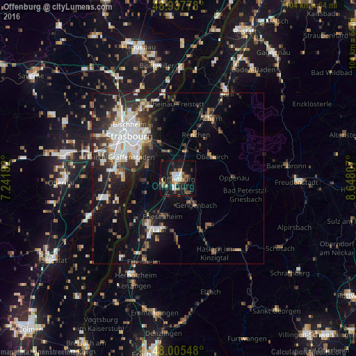
Analysis of Offenburg night lights 2016
Square area 10x10 km:
 5.97%
5.97%90-99
3.69%80-89
2.7%70-79
1.99%60-69
4.55%50-59
3.55%40-49
4.26%30-39
5.54%20-29
6.11%10-19
38.35%0-9
23.3%Square area 50x50 km:
3.92%90-99
3.22%80-89
1.16%70-79
1.22%60-69
1.47%50-59
1.74%40-49
1.83%30-39
3.3%20-29
4.64%10-19
11.29%0-9
66.2%Clear (daylight) street map image can be seen on geolist.org.
Map coordinates:
48° 56' 16" North, 7° 14' 30.6" East
48° 28' 25.6" North, 7° 56' 41.8" East
48° 0' 19.7" North, 8° 38' 53.1" East
Some cities around Offenburg sort by population:
• Lahr
15.9 km =9.9 mi,  200°
200°
• Kehl
14.6 km =9.1 mi,  319°
319°
• Oberkirch
11.8 km =7.3 mi,  56°
56°
• Gengenbach
9.2 km =5.7 mi,  146°
146°
• Willstätt
8.4 km =5.2 mi,  332°
332°
• Schutterwald
5.3 km =3.3 mi,  239°
239°
• Renchen
13.7 km =8.5 mi,  21°
21°
• Haslach
13.1 km =8.1 mi,  38°
38°
2857798 (p: 59,238)
Sources (retrieved 2019-11-25):
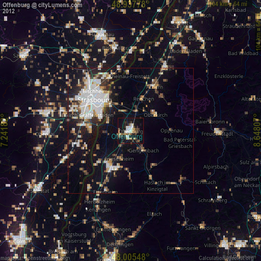
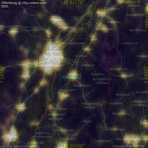
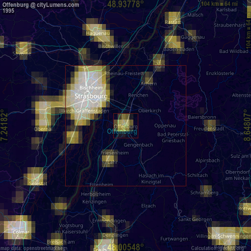
» NASA, Earths city lights 1995
» NASA city lights 2003
» Earth at Night: Flat Maps 2012, 2016