Ransbach-Baumbach night lights from space
Night Light of Ransbach-Baumbach (Rheinland-Pfalz) from space (Germany) Src. Average luminocity for 10x10km area is 11.6415% and for 50x50km: 7.3284%.
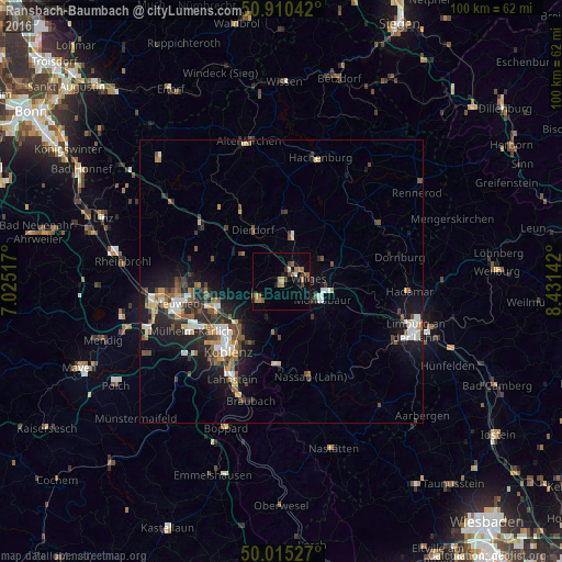
Analysis of Ransbach-Baumbach night lights 2016
Square area 10x10 km:
 0.28%
0.28%90-99
0.28%80-89
0.7%70-79
1.68%60-69
5.32%50-59
2.38%40-49
1.26%30-39
2.38%20-29
0.98%10-19
1.4%0-9
83.33%Square area 50x50 km:
0.89%90-99
1.13%80-89
0.64%70-79
0.65%60-69
1.03%50-59
1.25%40-49
1.3%30-39
0.97%20-29
2.29%10-19
5.45%0-9
84.41%Clear (daylight) street map image can be seen on geolist.org.
Map coordinates:
50° 54' 37.5" North, 7° 1' 30.6" East
50° 27' 53.9" North, 7° 43' 41.9" East
50° 0' 55" North, 8° 25' 53.1" East
Some cities around Ransbach-Baumbach sort by population:
• Koblenz
16.3 km =10.1 mi,  220°
220°
• Bendorf
11.5 km =7.1 mi,  246°
246°
• Montabaur
7.5 km =4.7 mi,  115°
115°
• Höhr-Grenzhausen
5.4 km =3.4 mi,  231°
231°
• Bad Ems
14.4 km =8.9 mi,  184°
184°
• Vallendar
10.6 km =6.6 mi, 223°
• Dierdorf
10.5 km =6.5 mi,  329°
329°
• Wirges
5 km =3.1 mi,  81°
81°
3225108 (p: 7,327)
Sources (retrieved 2019-11-25):
» Earth at Night: Flat Maps 2012, 2016