Bendorf night lights from space
Night Light of Bendorf (Rheinland-Pfalz) from space (Germany) Src. Average luminocity for 10x10km area is 32.0028% and for 50x50km: 8.0308%.
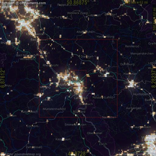
Analysis of Bendorf night lights 2016
Square area 10x10 km:
 4.62%
4.62%90-99
4.9%80-89
1.68%70-79
2.66%60-69
4.2%50-59
5.74%40-49
7.28%30-39
2.1%20-29
21.29%10-19
22.83%0-9
22.69%Square area 50x50 km:
0.86%90-99
1.07%80-89
0.72%70-79
0.7%60-69
1.26%50-59
1.35%40-49
1.53%30-39
1.19%20-29
2.48%10-19
4.83%0-9
83.99%Clear (daylight) street map image can be seen on geolist.org.
Map coordinates:
50° 52' 7.5" North, 6° 52' 34" East
50° 25' 22.4" North, 7° 34' 45.3" East
49° 58' 22.1" North, 8° 16' 56.5" East
Some cities around Bendorf sort by population:
• Koblenz
7.7 km =4.8 mi,  180°
180°
• Neuwied
7.8 km =4.8 mi,  278°
278°
• Andernach
12.4 km =7.7 mi,  274°
274°
• Mülheim-Kärlich
7.1 km =4.4 mi,  233°
233°
• Höhr-Grenzhausen
6.5 km =4 mi,  78°
78°
• Vallendar
4.4 km =2.7 mi,  133°
133°
• Weißenthurm
9.1 km =5.7 mi, 266°
• Ransbach-Baumbach
11.5 km =7.1 mi,  66°
66°
2951111 (p: 17,495)
Sources (retrieved 2019-11-25):
» Earth at Night: Flat Maps 2012, 2016