Haslach night lights from space
Night Light of Haslach (Baden-Württemberg) from space (Germany) Src. Average luminocity for 10x10km area is 9.2321% and for 50x50km: 13.5793%.
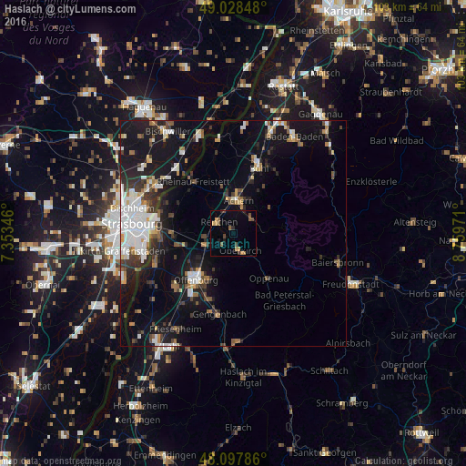
Analysis of Haslach night lights 2016
Square area 10x10 km:
 0%
0%90-99
0%80-89
0.15%70-79
3.13%60-69
1.19%50-59
3.27%40-49
2.08%30-39
0.74%20-29
0.89%10-19
1.34%0-9
87.2%Square area 50x50 km:
2.97%90-99
2.3%80-89
0.93%70-79
1.09%60-69
1.32%50-59
1.4%40-49
1.5%30-39
2.14%20-29
3.07%10-19
12.04%0-9
71.23%Clear (daylight) street map image can be seen on geolist.org.
Map coordinates:
49° 1' 42.5" North, 7° 21' 12.5" East
48° 33' 55.1" North, 8° 3' 23.7" East
48° 5' 52.3" North, 8° 45' 35" East
Some cities around Haslach sort by population:
• Offenburg
13.1 km =8.1 mi,  218°
218°
• Achern
7.5 km =4.7 mi,  11°
11°
• Oberkirch
4 km =2.5 mi,  156°
156°
• Willstätt
12.3 km =7.6 mi,  257°
257°
• Renchen
4.1 km =2.5 mi,  308°
308°
• Ottersweier
12.4 km =7.7 mi,  19°
19°
• Kappelrodeck
5.3 km =3.3 mi,  56°
56°
• Sasbach
8.7 km =5.4 mi, 18°
2909544 (p: 6,874)
Sources (retrieved 2019-11-25):
» Earth at Night: Flat Maps 2012, 2016