Oerlinghausen night lights from space
Night Light of Oerlinghausen (North Rhine-Westphalia) from space (Germany) Src. Average luminocity for 10x10km area is 9.4003% and for 50x50km: 8.4734%.
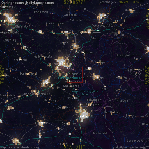
Analysis of Oerlinghausen night lights 2016
Square area 10x10 km:
 0%
0%90-99
1.52%80-89
0.76%70-79
0.51%60-69
0.88%50-59
2.15%40-49
1.64%30-39
2.15%20-29
1.01%10-19
12.75%0-9
76.64%Square area 50x50 km:
0.75%90-99
1.08%80-89
0.95%70-79
0.92%60-69
1.13%50-59
1.37%40-49
1.48%30-39
0.95%20-29
2.02%10-19
7.07%0-9
82.29%Clear (daylight) street map image can be seen on geolist.org.
Map coordinates:
52° 23' 8.8" North, 7° 57' 32.7" East
51° 57' 16.3" North, 8° 39' 43.9" East
51° 31' 8.8" North, 9° 21' 55.2" East
Some cities around Oerlinghausen sort by population:
• Bielefeld
12.4 km =7.7 mi,  314°
314°
• Detmold
14.6 km =9.1 mi,  97°
97°
• Bad Salzuflen
15.7 km =9.8 mi,  21°
21°
• Lage
9.9 km =6.2 mi,  64°
64°
• Verl
12.7 km =7.9 mi,  231°
231°
• Leopoldshöhe
6.9 km =4.3 mi, 21°
• Hövelhof
15.4 km =9.6 mi,  183°
183°
• Augustdorf
6.9 km =4.3 mi,  136°
136°
2857900 (p: 17,403)
Sources (retrieved 2019-11-25):
» Earth at Night: Flat Maps 2012, 2016