Bad Salzuflen night lights from space
Night Light of Bad Salzuflen (North Rhine-Westphalia) from space (Germany) Src. Average luminocity for 10x10km area is 9.1402% and for 50x50km: 8.3554%.
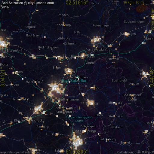
Analysis of Bad Salzuflen night lights 2016
Square area 10x10 km:
 0.53%
0.53%90-99
2.25%80-89
0.53%70-79
0.4%60-69
1.32%50-59
2.91%40-49
1.98%30-39
0.13%20-29
1.06%10-19
3.17%0-9
85.71%Square area 50x50 km:
0.83%90-99
1.15%80-89
0.81%70-79
0.82%60-69
1.22%50-59
1.39%40-49
1.56%30-39
1.04%20-29
1.84%10-19
5.85%0-9
83.5%Clear (daylight) street map image can be seen on geolist.org.
Map coordinates:
52° 30' 58.2" North, 8° 2' 28.4" East
52° 5' 10.3" North, 8° 44' 39.6" East
51° 39' 7.4" North, 9° 26' 50.9" East
Some cities around Bad Salzuflen sort by population:
• Herford
5.8 km =3.6 mi,  303°
303°
• Lemgo
12.4 km =7.7 mi,  121°
121°
• Löhne
11.9 km =7.4 mi,  342°
342°
• Lage
11 km =6.8 mi,  162°
162°
• Hiddenhausen
12.5 km =7.8 mi,  315°
315°
• Vlotho
11.8 km =7.3 mi,  41°
41°
• Leopoldshöhe
8.8 km =5.5 mi,  200°
200°
• Obernbeck
13.1 km =8.1 mi,  347°
347°
2953358 (p: 54,899)
Sources (retrieved 2019-11-25):
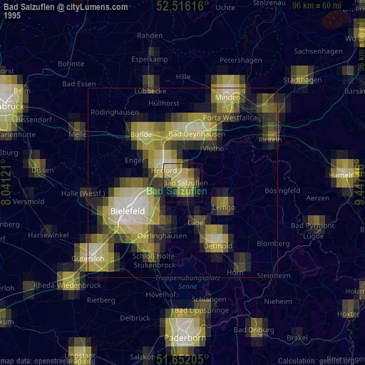
» NASA, Earths city lights 1995
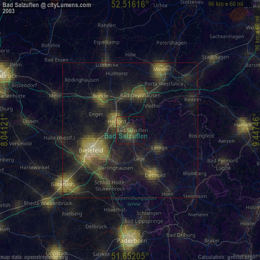
» NASA city lights 2003
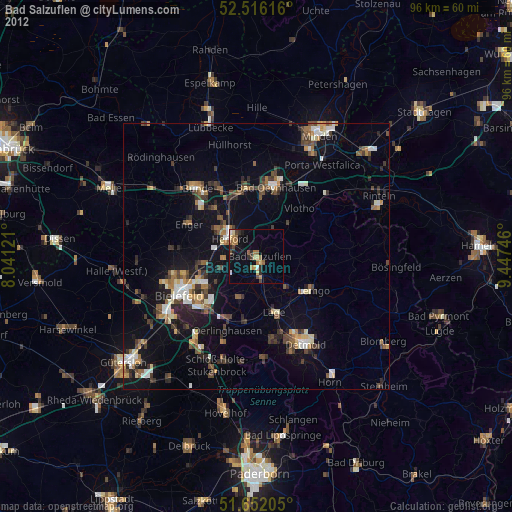
» Earth at Night: Flat Maps 2012, 2016