Detmold night lights from space
Night Light of Detmold (North Rhine-Westphalia) from space (Germany) Src. Average luminocity for 10x10km area is 14.5139% and for 50x50km: 6.6681%.
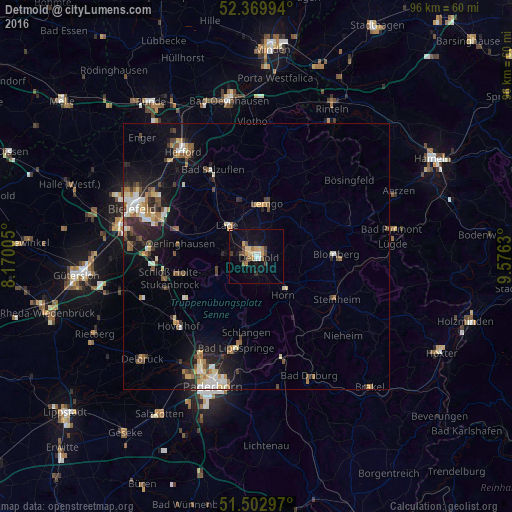
Analysis of Detmold night lights 2016
Square area 10x10 km:
 1.26%
1.26%90-99
0.76%80-89
2.4%70-79
2.27%60-69
2.53%50-59
1.64%40-49
2.78%30-39
1.52%20-29
0.76%10-19
9.85%0-9
74.24%Square area 50x50 km:
0.7%90-99
1.01%80-89
0.83%70-79
0.67%60-69
0.92%50-59
0.98%40-49
1.14%30-39
0.76%20-29
1.63%10-19
4.56%0-9
86.8%Clear (daylight) street map image can be seen on geolist.org.
Map coordinates:
52° 22' 11.8" North, 8° 10' 12.2" East
51° 56' 18.8" North, 8° 52' 23.4" East
51° 30' 10.7" North, 9° 34' 34.7" East
Some cities around Detmold sort by population:
• Lemgo
10.1 km =6.3 mi,  10°
10°
• Lage
8.1 km =5 mi,  317°
317°
• Oerlinghausen
14.6 km =9.1 mi,  277°
277°
• Leopoldshöhe
14.5 km =9 mi,  304°
304°
• Augustdorf
10.2 km =6.3 mi,  251°
251°
• Schlangen
14.4 km =8.9 mi,  187°
187°
• Dörentrup
14.4 km =8.9 mi,  37°
37°
• Horn
8.9 km =5.5 mi,  146°
146°
2937936 (p: 73,680)
Sources (retrieved 2019-11-25):
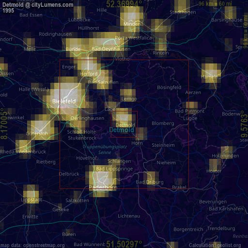
» NASA, Earths city lights 1995
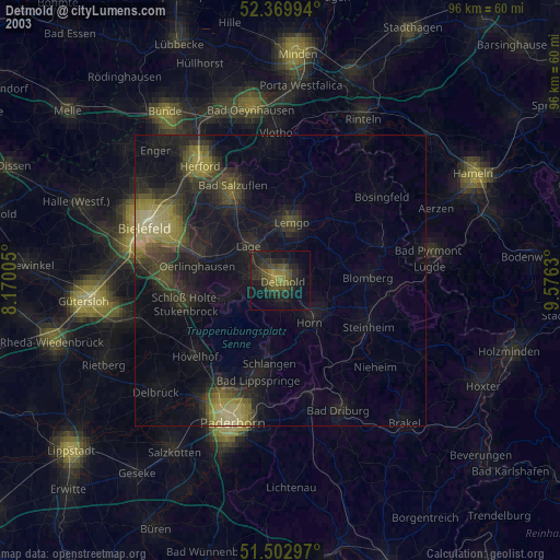
» NASA city lights 2003
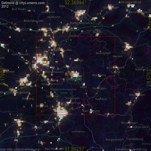
» Earth at Night: Flat Maps 2012, 2016