Marpingen night lights from space
Night Light of Marpingen (Saarland) from space (Germany) Src. Average luminocity for 10x10km area is 0.8641% and for 50x50km: 11.7085%.
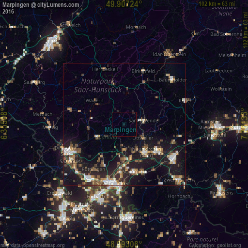
Analysis of Marpingen night lights 2016
Square area 10x10 km:
 0%
0%90-99
0%80-89
0%70-79
0%60-69
0%50-59
0%40-49
0%30-39
0%20-29
0.84%10-19
2.1%0-9
97.06%Square area 50x50 km:
1.49%90-99
1.59%80-89
1.01%70-79
1.06%60-69
1.39%50-59
1.78%40-49
2.16%30-39
1.8%20-29
3.85%10-19
12.31%0-9
71.57%Clear (daylight) street map image can be seen on geolist.org.
Map coordinates:
49° 54' 26.1" North, 6° 21' 18.3" East
49° 27' 8.2" North, 7° 3' 29.5" East
48° 59' 35" North, 7° 45' 40.8" East
Some cities around Marpingen sort by population:
• Sankt Wendel
8.1 km =5 mi,  78°
78°
• Illingen
8.8 km =5.5 mi,  185°
185°
• Eppelborn
8.8 km =5.5 mi,  228°
228°
• Schiffweiler
11 km =6.8 mi,  150°
150°
• Ottweiler
9.5 km =5.9 mi,  126°
126°
• Tholey
3.8 km =2.4 mi,  336°
336°
• Namborn
9.7 km =6 mi,  37°
37°
• Oberthal
7 km =4.3 mi,  15°
15°
2873224 (p: 11,358)
Sources (retrieved 2019-11-25):
» Earth at Night: Flat Maps 2012, 2016