Ottweiler night lights from space
Night Light of Ottweiler (Saarland) from space (Germany) Src. Average luminocity for 10x10km area is 12.6297% and for 50x50km: 12.1253%.
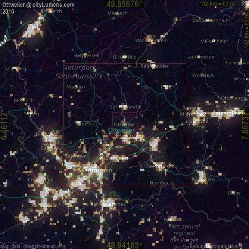
Analysis of Ottweiler night lights 2016
Square area 10x10 km:
 0.4%
0.4%90-99
1.2%80-89
0%70-79
1.34%60-69
0.8%50-59
1.2%40-49
3.34%30-39
4.41%20-29
1.34%10-19
23.8%0-9
62.17%Square area 50x50 km:
1.61%90-99
1.9%80-89
1.03%70-79
1.09%60-69
1.23%50-59
1.78%40-49
2.09%30-39
2.53%20-29
4.12%10-19
10.48%0-9
72.15%Clear (daylight) street map image can be seen on geolist.org.
Map coordinates:
49° 51' 24.3" North, 6° 27' 40" East
49° 24' 4.8" North, 7° 9' 51.3" East
48° 56' 29.9" North, 7° 52' 2.5" East
Some cities around Ottweiler sort by population:
• Neunkirchen
6.4 km =4 mi,  169°
169°
• Sankt Wendel
7.2 km =4.5 mi,  2°
2°
• Bexbach
9 km =5.6 mi,  132°
132°
• Illingen
9 km =5.6 mi,  249°
249°
• Schiffweiler
4.5 km =2.8 mi,  210°
210°
• Spiesen-Elversberg
9.7 km =6 mi,  193°
193°
• Friedrichsthal
9.5 km =5.9 mi, 211°
• Marpingen
9.5 km =5.9 mi,  306°
306°
2855917 (p: 15,503)
Sources (retrieved 2019-11-25):
» Earth at Night: Flat Maps 2012, 2016