Mariendorf night lights from space
Night Light of Mariendorf (Berlin) from space (Germany) Src. Average luminocity for 10x10km area is 85.5556% and for 50x50km: 37.5195%.
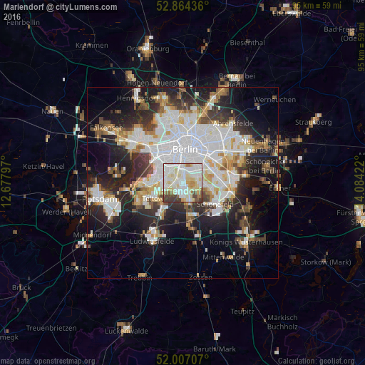
Analysis of Mariendorf night lights 2016
Square area 10x10 km:
 28.03%
90-99
34.97%80-89
13.64%70-79
4.29%60-69
4.42%50-59
3.41%40-49
4.67%30-39
6.57%20-29
0%10-19
0%0-9
0%Square area 50x50 km:
10.88%90-99
9.39%80-89
3.63%70-79
3.08%60-69
3.13%50-59
3.42%40-49
3.88%30-39
4.35%20-29
8.72%10-19
14.94%0-9
34.58%Clear (daylight) street map image can be seen on geolist.org.
Map coordinates:
52° 51' 51.7" North, 12° 40' 40.7" East
52° 26' 16.1" North, 13° 22' 51.9" East
52° 0' 25.5" North, 14° 5' 3.2" East
Some cities around Mariendorf sort by population:
• Schöneberg
3.8 km =2.4 mi,  326°
326°
• Lichterfelde
5 km =3.1 mi,  264°
264°
• Steglitz
3.9 km =2.4 mi,  301°
301°
• Tempelhof
3.5 km =2.2 mi,  21°
21°
• Lichtenrade
4.7 km =2.9 mi,  158°
158°
• Lankwitz
2.4 km =1.5 mi,  265°
265°
• Britz
3.6 km =2.2 mi,  80°
80°
• Friedenau
5.2 km =3.2 mi,  316°
316°
2873606 (p: 49,917)
Sources (retrieved 2019-11-25):
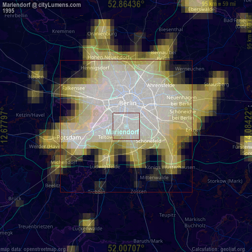
» NASA, Earths city lights 1995
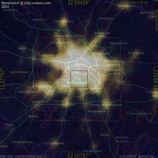
» NASA city lights 2003
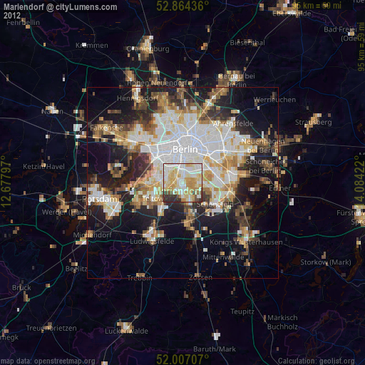
» Earth at Night: Flat Maps 2012, 2016