Lichtenrade night lights from space
Night Light of Lichtenrade (Berlin) from space (Germany) Src. Average luminocity for 10x10km area is 61.1742% and for 50x50km: 35.5407%.
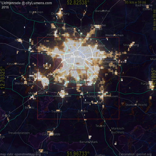
Analysis of Lichtenrade night lights 2016
Square area 10x10 km:
 12.12%
90-99
17.42%80-89
9.85%70-79
5.81%60-69
4.8%50-59
5.68%40-49
8.84%30-39
13.38%20-29
17.05%10-19
5.05%0-9
0%Square area 50x50 km:
10.76%90-99
9.07%80-89
3.42%70-79
2.96%60-69
2.74%50-59
3.02%40-49
3.69%30-39
4.11%20-29
7.69%10-19
12.73%0-9
39.8%Clear (daylight) street map image can be seen on geolist.org.
Map coordinates:
52° 49' 31.4" North, 12° 42' 11.7" East
52° 23' 54.4" North, 13° 24' 22.9" East
51° 58' 2.4" North, 14° 6' 34.2" East
Some cities around Lichtenrade sort by population:
• Mariendorf
4.7 km =2.9 mi,  338°
338°
• Lankwitz
5.9 km =3.7 mi,  315°
315°
• Rudow
6.1 km =3.8 mi,  61°
61°
• Britz
5.3 km =3.3 mi,  20°
20°
• Buckow
5.2 km =3.2 mi,  44°
44°
• Gropiusstadt
5 km =3.1 mi,  54°
54°
• Marienfelde
3.5 km =2.2 mi,  310°
310°
• Schönefeld
6.7 km =4.2 mi,  99°
99°
2878044 (p: 49,489)
Sources (retrieved 2019-11-25):
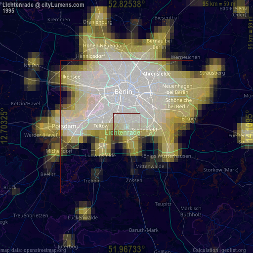
» NASA, Earths city lights 1995
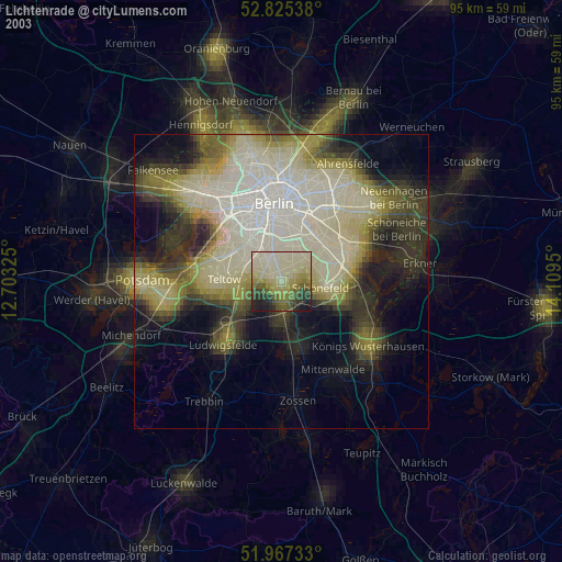
» NASA city lights 2003
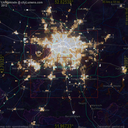
» Earth at Night: Flat Maps 2012, 2016