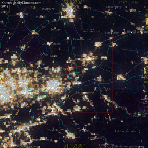
Kamen night lights from space
Night Light of Kamen (North Rhine-Westphalia) from space (Germany) Src. Average luminocity for 10x10km area is 31.3917% and for 50x50km: 21.2687%.
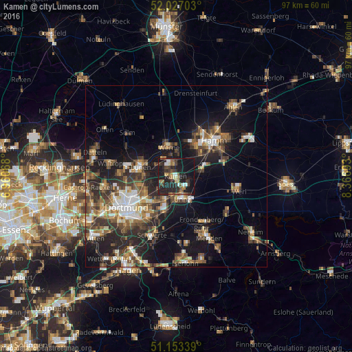
Analysis of Kamen night lights 2016
Square area 10x10 km:
 3.07%
3.07%90-99
2.94%80-89
3.21%70-79
2.14%60-69
4.81%50-59
5.35%40-49
4.55%30-39
7.09%20-29
17.91%10-19
42.78%0-9
6.15%Square area 50x50 km:
2.59%90-99
3.03%80-89
1.65%70-79
2.21%60-69
3.41%50-59
4.12%40-49
3.91%30-39
4.45%20-29
6.81%10-19
14.14%0-9
53.66%Clear (daylight) street map image can be seen on geolist.org.
Map coordinates:
52° 1' 37.3" North, 6° 57' 38.4" East
51° 35' 32.3" North, 7° 39' 49.7" East
51° 9' 12.2" North, 8° 22' 0.9" East
Some cities around Kamen sort by population:
• Hamm
14.6 km =9.1 mi,  47°
47°
• Lünen
9.7 km =6 mi,  285°
285°
• Unna
6.3 km =3.9 mi,  163°
163°
• Bergkamen
3 km =1.9 mi,  333°
333°
• Werne
8.3 km =5.2 mi,  345°
345°
• Fröndenberg
14.9 km =9.3 mi,  150°
150°
• Bönen
7.2 km =4.5 mi,  83°
83°
• Holzwickede
10.5 km =6.5 mi,  191°
191°
2893438 (p: 45,927)
Sources (retrieved 2019-11-25):
» Earth at Night: Flat Maps 2012, 2016