Bergkamen night lights from space
Night Light of Bergkamen (North Rhine-Westphalia) from space (Germany) Src. Average luminocity for 10x10km area is 28.5561% and for 50x50km: 20.4631%.
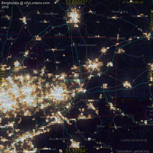
Analysis of Bergkamen night lights 2016
Square area 10x10 km:
 2.27%
2.27%90-99
2.41%80-89
3.48%70-79
1.74%60-69
4.01%50-59
4.68%40-49
4.95%30-39
6.68%20-29
8.69%10-19
54.41%0-9
6.68%Square area 50x50 km:
2.43%90-99
2.82%80-89
1.5%70-79
2.11%60-69
3.35%50-59
3.98%40-49
3.89%30-39
4.65%20-29
6.7%10-19
13.65%0-9
54.93%Clear (daylight) street map image can be seen on geolist.org.
Map coordinates:
52° 3' 3" North, 6° 56' 29" East
51° 36' 58.8" North, 7° 38' 40.2" East
51° 10' 39.5" North, 8° 20' 51.5" East
Some cities around Bergkamen sort by population:
• Hamm
14.1 km =8.8 mi,  59°
59°
• Lünen
8 km =5 mi,  270°
270°
• Unna
9.3 km =5.8 mi,  160°
160°
• Kamen
3 km =1.9 mi,  153°
153°
• Werne
5.4 km =3.4 mi,  352°
352°
• Selm
15.1 km =9.4 mi,  306°
306°
• Bönen
8.6 km =5.3 mi,  102°
102°
• Holzwickede
13 km =8.1 mi,  183°
183°
2950344 (p: 52,329)
Sources (retrieved 2019-11-25):
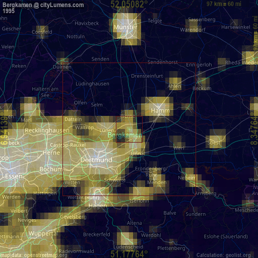
» NASA, Earths city lights 1995
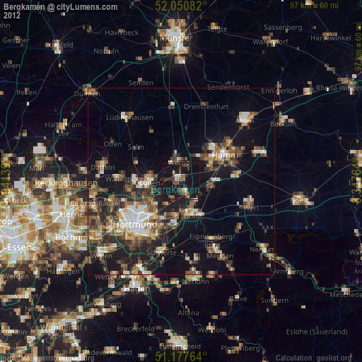
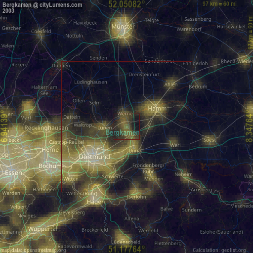
» NASA city lights 2003
» Earth at Night: Flat Maps 2012, 2016