Lebach night lights from space
Night Light of Lebach (Saarland) from space (Germany) Src. Average luminocity for 10x10km area is 4.6457% and for 50x50km: 12.8085%.
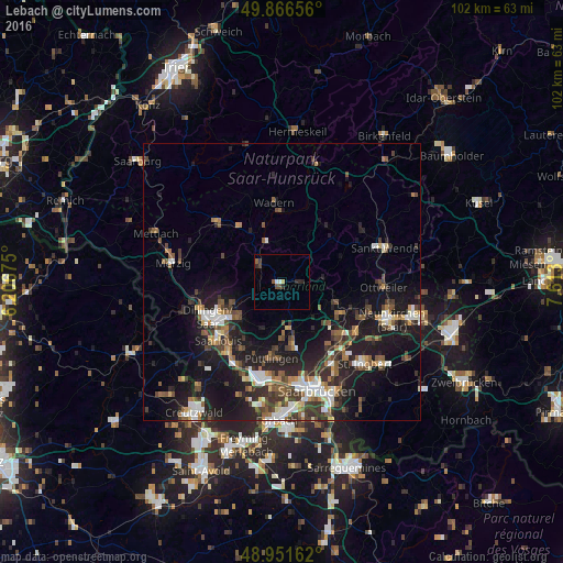
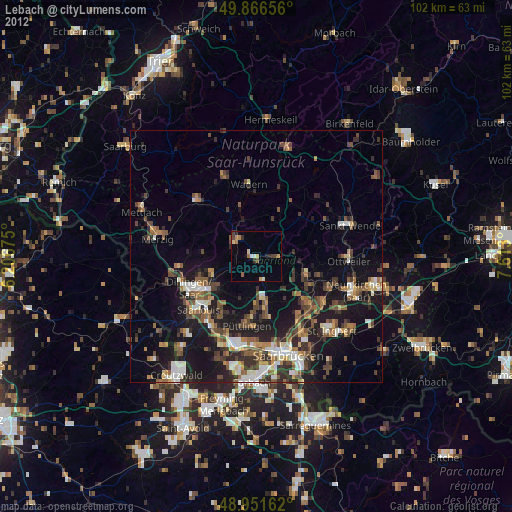
Analysis of Lebach night lights 2016
Square area 10x10 km:
 0.67%
0.67%90-99
0.4%80-89
0%70-79
0.53%60-69
0%50-59
1.07%40-49
1.2%30-39
0.94%20-29
2.67%10-19
0%0-9
92.51%Square area 50x50 km:
1.72%90-99
1.87%80-89
0.87%70-79
1.02%60-69
1.58%50-59
2.23%40-49
2.33%30-39
2.68%20-29
4.36%10-19
11.96%0-9
69.39%Clear (daylight) street map image can be seen on geolist.org.
Map coordinates:
49° 51' 59.6" North, 6° 12' 24.3" East
49° 24' 40.4" North, 6° 54' 35.6" East
48° 57' 5.8" North, 7° 36' 46.8" East
Some cities around Lebach sort by population:
• Heusweiler
8.5 km =5.3 mi,  169°
169°
• Illingen
10.8 km =6.7 mi,  112°
112°
• Eppelborn
4.3 km =2.7 mi, 106°
• Schmelz
5 km =3.1 mi,  299°
299°
• Saarwellingen
9.9 km =6.2 mi,  230°
230°
• Tholey
12.2 km =7.6 mi,  48°
48°
• Marpingen
11.7 km =7.3 mi,  66°
66°
• Nalbach
9.7 km =6 mi,  251°
251°
2879832 (p: 21,583)
Sources (retrieved 2019-11-25):
» Earth at Night: Flat Maps 2012, 2016