Kamp-Lintfort night lights from space
Night Light of Kamp-Lintfort (North Rhine-Westphalia) from space (Germany) Src. Average luminocity for 10x10km area is 17.6939% and for 50x50km: 24.5774%.
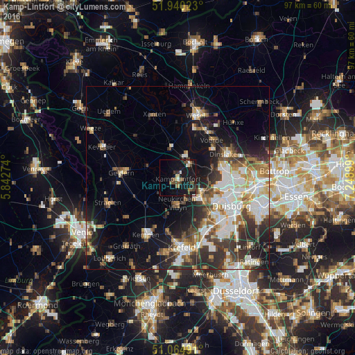
Analysis of Kamp-Lintfort night lights 2016
Square area 10x10 km:
 1.07%
1.07%90-99
1.47%80-89
1.6%70-79
0.94%60-69
1.74%50-59
3.61%40-49
5.61%30-39
3.34%20-29
2.27%10-19
31.28%0-9
47.06%Square area 50x50 km:
4.98%90-99
5.17%80-89
2.28%70-79
2.55%60-69
2.61%50-59
3.38%40-49
3.38%30-39
4.54%20-29
5.74%10-19
11.21%0-9
54.15%Clear (daylight) street map image can be seen on geolist.org.
Map coordinates:
51° 56' 24.8" North, 5° 50' 33.9" East
51° 30' 16.8" North, 6° 32' 45.1" East
51° 3' 53.7" North, 7° 14' 56.4" East
Some cities around Kamp-Lintfort sort by population:
• Moers
8.3 km =5.2 mi,  133°
133°
• Dinslaken
15.1 km =9.4 mi,  64°
64°
• Voerde
14.1 km =8.8 mi,  43°
43°
• Geldern
15.5 km =9.6 mi,  275°
275°
• Rheinberg
5.8 km =3.6 mi, 36°
• Alpen
9 km =5.6 mi,  347°
347°
• Issum
8.4 km =5.2 mi,  292°
292°
• Rheurdt
6.9 km =4.3 mi,  232°
232°
2893264 (p: 39,490)
Sources (retrieved 2019-11-25):
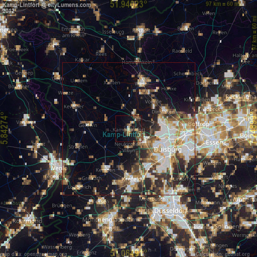
» Earth at Night: Flat Maps 2012, 2016