Dinslaken night lights from space
Night Light of Dinslaken (North Rhine-Westphalia) from space (Germany) Src. Average luminocity for 10x10km area is 46.7246% and for 50x50km: 31.989%.
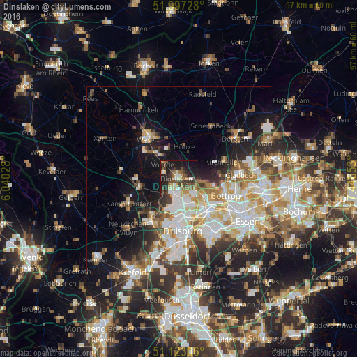
Analysis of Dinslaken night lights 2016
Square area 10x10 km:
 8.02%
8.02%90-99
8.42%80-89
5.48%70-79
5.21%60-69
5.75%50-59
8.56%40-49
7.75%30-39
9.49%20-29
13.37%10-19
23.93%0-9
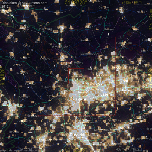
4.01%Square area 50x50 km:
7.6%90-99
7.32%80-89
3.66%70-79
3.54%60-69
3.77%50-59
3.97%40-49
3.35%30-39
4.27%20-29
6.3%10-19
11.46%0-9
44.78%Clear (daylight) street map image can be seen on geolist.org.
Map coordinates:
51° 59' 50.2" North, 6° 2' 25" East
51° 33' 44.2" North, 6° 44' 36.2" East
51° 7' 23" North, 7° 26' 47.5" East
Some cities around Dinslaken sort by population:
• Oberhausen
12.5 km =7.8 mi,  138°
138°
• Bottrop
13.5 km =8.4 mi,  108°
108°
• Moers
14.3 km =8.9 mi,  212°
212°
• Wesel
14.4 km =8.9 mi,  323°
323°
• Meiderich
10.8 km =6.7 mi,  171°
171°
• Voerde
5.5 km =3.4 mi,  314°
314°
• Rheinberg
10.4 km =6.5 mi,  260°
260°
• Hünxe
8.6 km =5.3 mi,  338°
338°
2936871 (p: 70,573)
Sources (retrieved 2019-11-25):
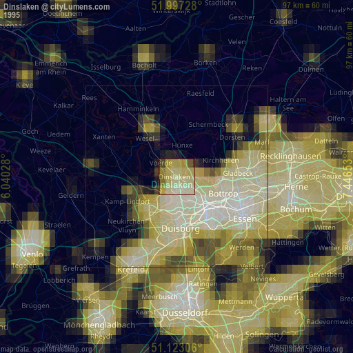
» NASA, Earths city lights 1995
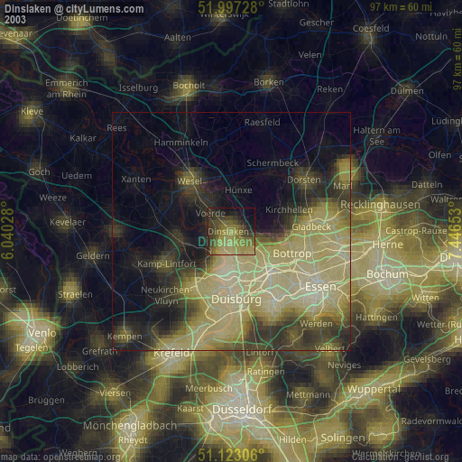
» NASA city lights 2003
» Earth at Night: Flat Maps 2012, 2016