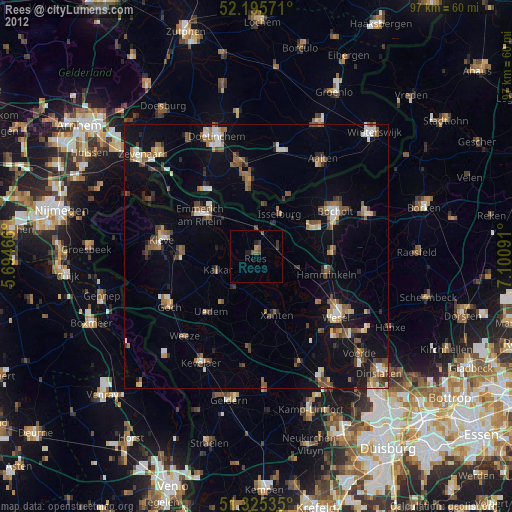
Rees night lights from space
Night Light of Rees (North Rhine-Westphalia) from space (Germany) Src. Average luminocity for 10x10km area is 2.895% and for 50x50km: 9.8066%.
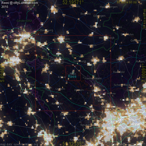
Analysis of Rees night lights 2016
Square area 10x10 km:
 0%
0%90-99
0%80-89
0%70-79
0.56%60-69
0.56%50-59
1.12%40-49
1.12%30-39
0.28%20-29
1.4%10-19
0.7%0-9
94.26%Square area 50x50 km:
0.86%90-99
1.28%80-89
1.06%70-79
0.96%60-69
1.28%50-59
1.85%40-49
1.47%30-39
0.99%20-29
1.38%10-19
8.89%0-9
79.96%Clear (daylight) street map image can be seen on geolist.org.
Map coordinates:
52° 11' 44.6" North, 5° 41' 40.8" East
51° 45' 45.5" North, 6° 23' 52" East
51° 19' 31.3" North, 7° 6' 3.3" East
Some cities around Rees sort by population:
• Bocholt
17.2 km =10.7 mi,  60°
60°
• Emmerich
13.4 km =8.3 mi,  309°
309°
• Hamminkeln
13.7 km =8.5 mi,  104°
104°
• Xanten
12.2 km =7.6 mi,  161°
161°
• Kalkar
7.8 km =4.8 mi,  250°
250°
• Isselburg
9 km =5.6 mi,  30°
30°
• Uedem
13.8 km =8.6 mi,  218°
218°
• Mehrhoog
8.3 km =5.2 mi,  109°
109°
2849548 (p: 22,544)
Sources (retrieved 2019-11-25):
» Earth at Night: Flat Maps 2012, 2016