Haltern am See night lights from space
Night Light of Haltern am See (North Rhine-Westphalia) from space (Germany) Src. Average luminocity for 10x10km area is 8.6807% and for 50x50km: 18.9994%.
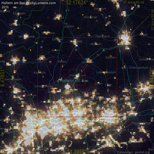
Analysis of Haltern am See night lights 2016
Square area 10x10 km:
 0.7%
0.7%90-99
0.42%80-89
0.98%70-79
0.7%60-69
1.68%50-59
0.98%40-49
1.68%30-39
1.26%20-29
0.56%10-19
7%0-9
84.03%Square area 50x50 km:
2.85%90-99
3.36%80-89
1.68%70-79
2.51%60-69
3.56%50-59
3.74%40-49
2.94%30-39
3.1%20-29
4.82%10-19
6.52%0-9
64.93%Clear (daylight) street map image can be seen on geolist.org.
Map coordinates:
52° 10' 34.5" North, 6° 28' 42.6" East
51° 44' 34.7" North, 7° 10' 53.9" East
51° 18' 19.8" North, 7° 53' 5.1" East
Some cities around Haltern am See sort by population:
• Recklinghausen
14.4 km =8.9 mi,  175°
175°
• Marl
11.5 km =7.1 mi,  213°
213°
• Herten
16.5 km =10.3 mi,  189°
189°
• Dülmen
12 km =7.5 mi,  34°
34°
• Datteln
14.9 km =9.3 mi,  130°
130°
• Oer-Erkenschwick
12.6 km =7.8 mi,  153°
153°
• Klein Reken
10.7 km =6.6 mi,  297°
297°
• Olfen
14.1 km =8.8 mi,  106°
106°
2911395 (p: 37,788)
Sources (retrieved 2019-11-25):
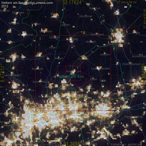
» Earth at Night: Flat Maps 2012, 2016