Dülmen night lights from space
Night Light of Dülmen (North Rhine-Westphalia) from space (Germany) Src. Average luminocity for 10x10km area is 6.0028% and for 50x50km: 9.4045%.
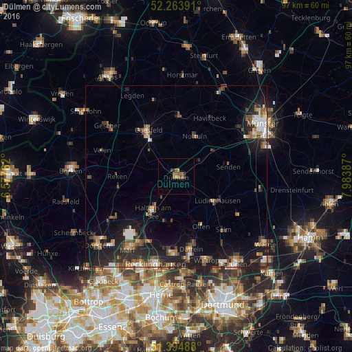
Analysis of Dülmen night lights 2016
Square area 10x10 km:
 0%
0%90-99
0%80-89
0.42%70-79
0.7%60-69
3.22%50-59
1.4%40-49
1.54%30-39
0.56%20-29
1.12%10-19
0.14%0-9
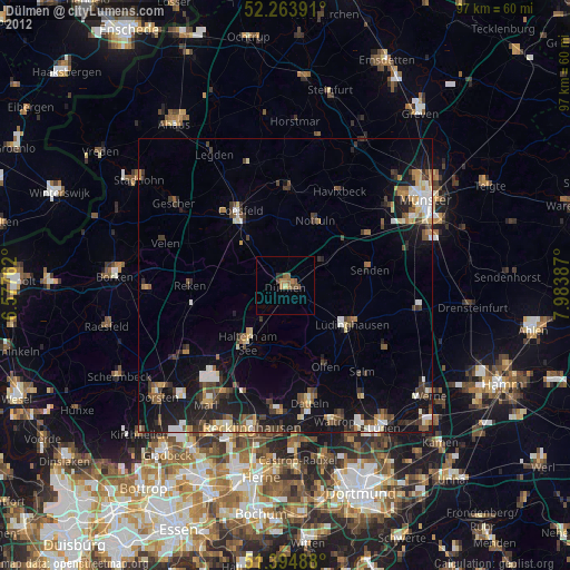
90.9%Square area 50x50 km:
1.02%90-99
1.24%80-89
0.59%70-79
1.09%60-69
1.37%50-59
1.68%40-49
1.73%30-39
1.44%20-29
3.52%10-19
7.68%0-9
78.62%Clear (daylight) street map image can be seen on geolist.org.
Map coordinates:
52° 15' 50.1" North, 6° 34' 39.4" East
51° 49' 53.4" North, 7° 16' 50.7" East
51° 23' 41.6" North, 7° 59' 1.9" East
Some cities around Dülmen sort by population:
• Haltern am See
12 km =7.5 mi,  214°
214°
• Coesfeld
14.7 km =9.1 mi,  328°
328°
• Lüdinghausen
13.2 km =8.2 mi,  122°
122°
• Nottuln
12.3 km =7.6 mi,  22°
22°
• Senden
14.2 km =8.8 mi,  78°
78°
• Klein Reken
17 km =10.6 mi,  253°
253°
• Olfen
15.3 km =9.5 mi,  153°
153°
• Billerbeck
16.3 km =10.1 mi,  2°
2°
2934662 (p: 47,495)
Sources (retrieved 2019-11-25):
» Earth at Night: Flat Maps 2012, 2016