Greiz night lights from space
Night Light of Greiz (Thuringia) from space (Germany) Src. Average luminocity for 10x10km area is 8.9853% and for 50x50km: 6.0612%.
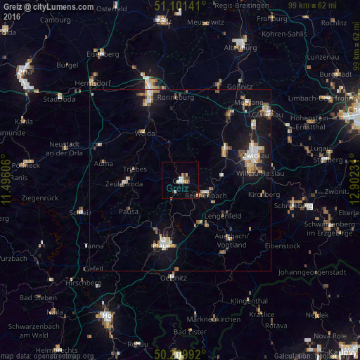
Analysis of Greiz night lights 2016
Square area 10x10 km:
 1.6%
1.6%90-99
1.6%80-89
1.2%70-79
0.94%60-69
0.8%50-59
0%40-49
1.07%30-39
2.14%20-29
0%10-19
0.53%0-9
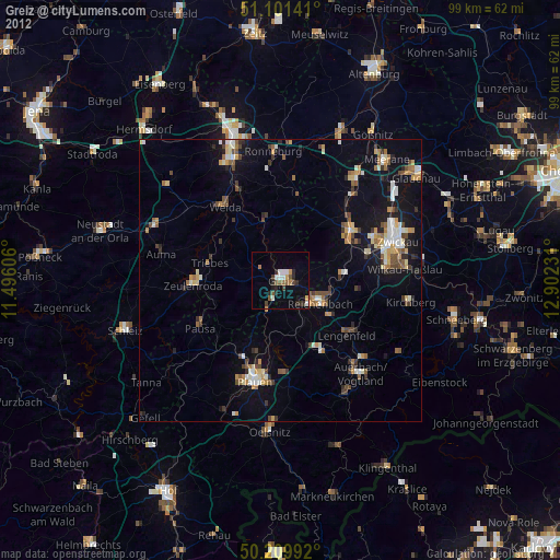
90.11%Square area 50x50 km:
0.75%90-99
0.9%80-89
0.6%70-79
0.88%60-69
0.74%50-59
0.94%40-49
0.55%30-39
0.62%20-29
0.77%10-19
5.26%0-9
88%Clear (daylight) street map image can be seen on geolist.org.
Map coordinates:
51° 6' 5.1" North, 11° 29' 45.8" East
50° 39' 28" North, 12° 11' 57" East
50° 12' 35.7" North, 12° 54' 8.3" East
Some cities around Greiz sort by population:
• Werdau
15.2 km =9.4 mi,  54°
54°
• Reichenbach/Vogtland
8.3 km =5.2 mi,  117°
117°
• Zeulenroda
15.2 km =9.4 mi,  267°
267°
• Treuen
14.8 km =9.2 mi,  150°
150°
• Weida
16.2 km =10.1 mi,  323°
323°
• Lengenfeld
15.2 km =9.4 mi,  130°
130°
• Fraureuth
11.6 km =7.2 mi,  66°
66°
• Elsterberg
5.9 km =3.7 mi,  201°
201°
2917737 (p: 24,147)
Sources (retrieved 2019-11-25):
» Earth at Night: Flat Maps 2012, 2016