Treuen night lights from space
Night Light of Treuen (Saxony) from space (Germany) Src. Average luminocity for 10x10km area is 3.9906% and for 50x50km: 4.6415%.
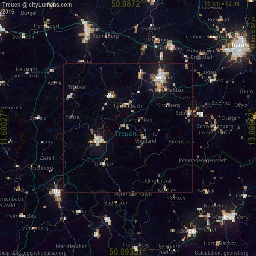
Analysis of Treuen night lights 2016
Square area 10x10 km:
 0%
0%90-99
0%80-89
0.4%70-79
0.53%60-69
1.87%50-59
1.47%40-49
0%30-39
0.53%20-29
0%10-19
0%0-9
95.19%Square area 50x50 km:
0.54%90-99
0.69%80-89
0.54%70-79
0.71%60-69
0.6%50-59
0.65%40-49
0.52%30-39
0.5%20-29
0.58%10-19
3.18%0-9
91.5%Clear (daylight) street map image can be seen on geolist.org.
Map coordinates:
50° 59' 13.9" North, 11° 36' 1" East
50° 32' 32.9" North, 12° 18' 12.2" East
50° 5' 36.6" North, 13° 0' 23.5" East
Some cities around Treuen sort by population:
• Plauen
12.7 km =7.9 mi,  246°
246°
• Greiz
14.8 km =9.2 mi,  330°
330°
• Reichenbach/Vogtland
8.9 km =5.5 mi,  0°
0°
• Auerbach
7.7 km =4.8 mi,  116°
116°
• Falkenstein
8.6 km =5.3 mi,  146°
146°
• Lengenfeld
5.2 km =3.2 mi,  55°
55°
• Rodewisch
7.9 km =4.9 mi,  99°
99°
• Elsterberg
12.1 km =7.5 mi,  307°
307°
2821251 (p: 9,189)
Sources (retrieved 2019-11-25):
» Earth at Night: Flat Maps 2012, 2016