Geithain night lights from space
Night Light of Geithain (Saxony) from space (Germany) Src. Average luminocity for 10x10km area is 1.1003% and for 50x50km: 4.9739%.
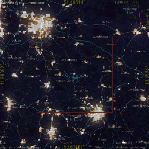
Analysis of Geithain night lights 2016
Square area 10x10 km:
 0%
0%90-99
0%80-89
0.53%70-79
0%60-69
0.53%50-59
0%40-49
0.53%30-39
0%20-29
0%10-19
0%0-9
98.4%Square area 50x50 km:
0.48%90-99
0.74%80-89
0.6%70-79
0.52%60-69
0.68%50-59
0.83%40-49
0.52%30-39
0.62%20-29
1.17%10-19
3.1%0-9
90.74%Clear (daylight) street map image can be seen on geolist.org.
Map coordinates:
51° 29' 42.5" North, 11° 59' 37" East
51° 3' 19" North, 12° 41' 48.3" East
50° 36' 40.4" North, 13° 23' 59.5" East
Some cities around Geithain sort by population:
• Penig
13.6 km =8.5 mi,  177°
177°
• Bad Lausick
10.6 km =6.6 mi,  339°
339°
• Frohburg
9.7 km =6 mi,  271°
271°
• Rochlitz
7.1 km =4.4 mi,  94°
94°
• Kitzscher
15.8 km =9.8 mi,  320°
320°
• Colditz
11 km =6.8 mi,  42°
42°
• Lunzenau
11.1 km =6.9 mi,  158°
158°
• Geringswalde
14.9 km =9.3 mi,  80°
80°
2921566 (p: 6,459)
Sources (retrieved 2019-11-25):
» Earth at Night: Flat Maps 2012, 2016