Geringswalde night lights from space
Night Light of Geringswalde (Saxony) from space (Germany) Src. Average luminocity for 10x10km area is 1.3583% and for 50x50km: 2.7629%.
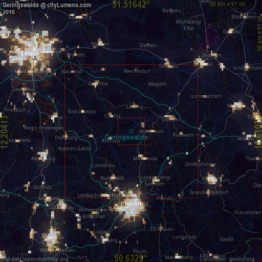
Analysis of Geringswalde night lights 2016
Square area 10x10 km:
 0%
0%90-99
0%80-89
0%70-79
0%60-69
0.53%50-59
1.07%40-49
0.53%30-39
0%20-29
0%10-19
0%0-9
97.86%Square area 50x50 km:
0.14%90-99
0.25%80-89
0.4%70-79
0.39%60-69
0.48%50-59
0.55%40-49
0.45%30-39
0.39%20-29
0.76%10-19
1.46%0-9
94.72%Clear (daylight) street map image can be seen on geolist.org.
Map coordinates:
51° 30' 59.1" North, 12° 12' 14.9" East
51° 4' 36.4" North, 12° 54' 26.1" East
50° 37' 58.4" North, 13° 36' 37.4" East
Some cities around Geringswalde sort by population:
• Döbeln
15 km =9.3 mi,  70°
70°
• Mittweida
11.1 km =6.9 mi,  154°
154°
• Waldheim
7.9 km =4.9 mi,  93°
93°
• Hartha
5.3 km =3.3 mi,  62°
62°
• Leisnig
9.1 km =5.7 mi,  9°
9°
• Rochlitz
8.2 km =5.1 mi,  248°
248°
• Geithain
14.9 km =9.3 mi,  260°
260°
• Colditz
9.3 km =5.8 mi,  308°
308°
2921089 (p: 5,125)
Sources (retrieved 2019-11-25):
» Earth at Night: Flat Maps 2012, 2016