Rochlitz night lights from space
Night Light of Rochlitz (Saxony) from space (Germany) Src. Average luminocity for 10x10km area is 0.5989% and for 50x50km: 4.3902%.
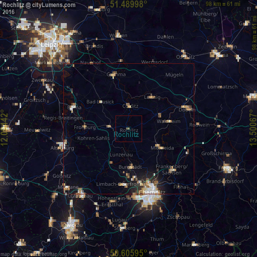
Analysis of Rochlitz night lights 2016
Square area 10x10 km:
 0%
0%90-99
0%80-89
0%70-79
0%60-69
0%50-59
0.53%40-49
0.53%30-39
0%20-29
0%10-19
0%0-9
98.93%Square area 50x50 km:
0.45%90-99
0.65%80-89
0.58%70-79
0.53%60-69
0.67%50-59
0.72%40-49
0.5%30-39
0.52%20-29
0.98%10-19
2.25%0-9
92.15%Clear (daylight) street map image can be seen on geolist.org.
Map coordinates:
51° 29' 23.9" North, 12° 5' 39.9" East
51° 3' 0.3" North, 12° 47' 51.1" East
50° 36' 21.4" North, 13° 30' 2.4" East
Some cities around Rochlitz sort by population:
• Mittweida
14.3 km =8.9 mi,  119°
119°
• Penig
14.5 km =9 mi,  206°
206°
• Hartha
13.5 km =8.4 mi,  66°
66°
• Leisnig
15 km =9.3 mi,  37°
37°
• Geithain
7.1 km =4.4 mi,  274°
274°
• Colditz
8.7 km =5.4 mi,  2°
2°
• Lunzenau
10.1 km =6.3 mi,  196°
196°
• Geringswalde
8.2 km =5.1 mi, 68°
2846261 (p: 6,847)
Sources (retrieved 2019-11-25):
» Earth at Night: Flat Maps 2012, 2016