Colditz night lights from space
Night Light of Colditz (Saxony) from space (Germany) Src. Average luminocity for 10x10km area is 1.6484% and for 50x50km: 2.7628%.
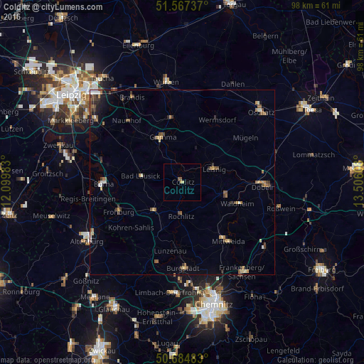
Analysis of Colditz night lights 2016
Square area 10x10 km:
 0%
0%90-99
0%80-89
0.53%70-79
0.53%60-69
0%50-59
1.07%40-49
0%30-39
0%20-29
0%10-19
0%0-9
97.86%Square area 50x50 km:
0.19%90-99
0.28%80-89
0.35%70-79
0.38%60-69
0.46%50-59
0.54%40-49
0.55%30-39
0.5%20-29
0.33%10-19
0.85%0-9
95.58%Clear (daylight) street map image can be seen on geolist.org.
Map coordinates:
51° 34' 2.5" North, 12° 5' 59.4" East
51° 7' 41.6" North, 12° 48' 10.6" East
50° 41' 5.4" North, 13° 30' 21.9" East
Some cities around Colditz sort by population:
• Grimma
13.1 km =8.1 mi,  333°
333°
• Bad Lausick
11.2 km =7 mi,  279°
279°
• Waldheim
16.4 km =10.2 mi,  112°
112°
• Hartha
12.4 km =7.7 mi, 105°
• Leisnig
9.3 km =5.8 mi,  69°
69°
• Rochlitz
8.7 km =5.4 mi,  182°
182°
• Geithain
11 km =6.8 mi,  222°
222°
• Geringswalde
9.3 km =5.8 mi,  128°
128°
2939927 (p: 5,173)
Sources (retrieved 2019-11-25):
» Earth at Night: Flat Maps 2012, 2016