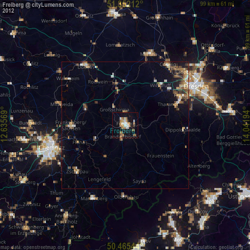
Freiberg night lights from space
Night Light of Freiberg (Saxony) from space (Germany) Src. Average luminocity for 10x10km area is 16.2899% and for 50x50km: 4.4651%.
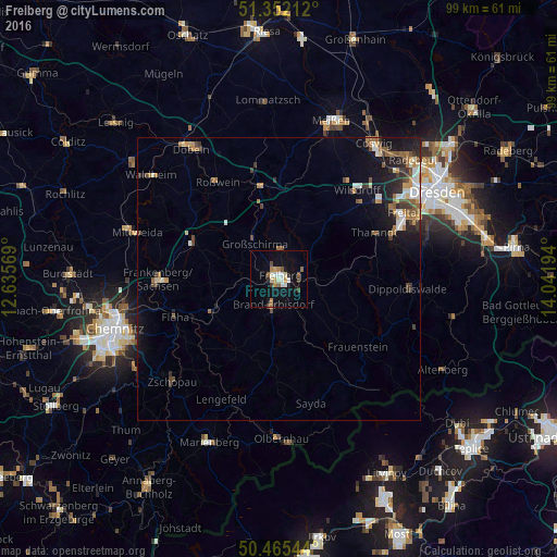
Analysis of Freiberg night lights 2016
Square area 10x10 km:
 1.82%
1.82%90-99
3.22%80-89
1.68%70-79
1.68%60-69
1.96%50-59
2.66%40-49
1.4%30-39
1.26%20-29
0.7%10-19
14.01%0-9
69.61%Square area 50x50 km:
0.49%90-99
0.71%80-89
0.33%70-79
0.53%60-69
0.67%50-59
0.75%40-49
0.74%30-39
0.62%20-29
0.96%10-19
3.26%0-9
90.95%Clear (daylight) street map image can be seen on geolist.org.
Map coordinates:
51° 21' 7.6" North, 12° 38' 8.5" East
50° 54' 39.2" North, 13° 20' 19.7" East
50° 27' 55.6" North, 14° 2' 31" East
Some cities around Freiberg sort by population:
• Brand-Erbisdorf
5.1 km =3.2 mi,  192°
192°
• Flöha
19.5 km =12.1 mi,  251°
251°
• Hainichen
16.5 km =10.3 mi,  293°
293°
• Nossen
16.6 km =10.3 mi,  349°
349°
• Oederan
13 km =8.1 mi,  244°
244°
• Großschirma
7.2 km =4.5 mi,  328°
328°
• Tharandt
18.8 km =11.7 mi,  63°
63°
• Augustusburg
19.9 km =12.4 mi, 236°
2925192 (p: 43,670)
Sources (retrieved 2019-11-25):
» Earth at Night: Flat Maps 2012, 2016