Oederan night lights from space
Night Light of Oederan (Saxony) from space (Germany) Src. Average luminocity for 10x10km area is 0.6457% and for 50x50km: 5.4598%.
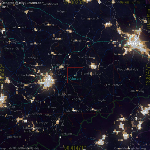
Analysis of Oederan night lights 2016
Square area 10x10 km:
 0%
0%90-99
0%80-89
0%70-79
0%60-69
0.56%50-59
0%40-49
0%30-39
0%20-29
0.98%10-19
0.14%0-9
98.32%Square area 50x50 km:
0.79%90-99
1.09%80-89
0.77%70-79
0.44%60-69
0.65%50-59
0.67%40-49
0.64%30-39
0.54%20-29
1.63%10-19
3.33%0-9
89.45%Clear (daylight) street map image can be seen on geolist.org.
Map coordinates:
51° 18' 8.5" North, 12° 28' 6.7" East
50° 51' 38.3" North, 13° 10' 17.9" East
50° 24' 53" North, 13° 52' 29.2" East
Some cities around Oederan sort by population:
• Freiberg
13 km =8.1 mi,  64°
64°
• Frankenberg
10.9 km =6.8 mi,  302°
302°
• Brand-Erbisdorf
10.6 km =6.6 mi,  86°
86°
• Flöha
6.9 km =4.3 mi,  265°
265°
• Hainichen
12.7 km =7.9 mi,  344°
344°
• Großschirma
14.2 km =8.8 mi,  34°
34°
• Niederwiesa
10.9 km =6.8 mi, 273°
• Augustusburg
7.3 km =4.5 mi,  222°
222°
2857970 (p: 7,143)
Sources (retrieved 2019-11-25):
» Earth at Night: Flat Maps 2012, 2016