Augustusburg night lights from space
Night Light of Augustusburg (Saxony) from space (Germany) Src. Average luminocity for 10x10km area is 0.3025% and for 50x50km: 6.0024%.
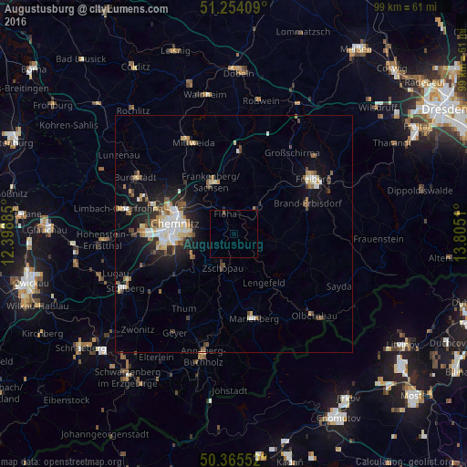
Analysis of Augustusburg night lights 2016
Square area 10x10 km:
 0%
0%90-99
0%80-89
0%70-79
0%60-69
0%50-59
0%40-49
0.56%30-39
0%20-29
0%10-19
0%0-9
99.44%Square area 50x50 km:
0.84%90-99
1.12%80-89
0.83%70-79
0.48%60-69
0.68%50-59
0.76%40-49
0.77%30-39
0.67%20-29
1.67%10-19
3.73%0-9
88.44%Clear (daylight) street map image can be seen on geolist.org.
Map coordinates:
51° 15' 14.7" North, 12° 23' 55.9" East
50° 48' 42.9" North, 13° 6' 7.1" East
50° 21' 55.9" North, 13° 48' 18.4" East
Some cities around Augustusburg sort by population:
• Chemnitz
12.4 km =7.7 mi,  282°
282°
• Frankenberg
12 km =7.5 mi,  338°
338°
• Zschopau
7.3 km =4.5 mi,  193°
193°
• Brand-Erbisdorf
16.7 km =10.4 mi,  68°
68°
• Flöha
5.3 km =3.3 mi, 338°
• Oederan
7.3 km =4.5 mi,  42°
42°
• Burkhardtsdorf
15.7 km =9.8 mi,  236°
236°
• Niederwiesa
8.5 km =5.3 mi,  315°
315°
2954127 (p: 5,202)
Sources (retrieved 2019-11-25):
» Earth at Night: Flat Maps 2012, 2016