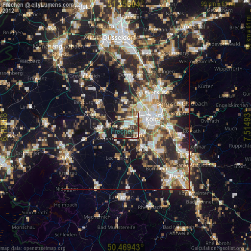
Frechen night lights from space
Night Light of Frechen (North Rhine-Westphalia) from space (Germany) Src. Average luminocity for 10x10km area is 49.042% and for 50x50km: 33.8095%.
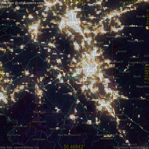
Analysis of Frechen night lights 2016
Square area 10x10 km:
 8.68%
8.68%90-99
10.22%80-89
5.32%70-79
3.78%60-69
5.6%50-59
6.86%40-49
7.7%30-39
15.69%20-29
17.09%10-19
19.05%0-9
0%Square area 50x50 km:
6.37%90-99
6.8%80-89
3.02%70-79
3.25%60-69
4.58%50-59
4.83%40-49
4.81%30-39
6.75%20-29
8.55%10-19
18.41%0-9
32.63%Clear (daylight) street map image can be seen on geolist.org.
Map coordinates:
51° 21' 21.7" North, 6° 6' 31.2" East
50° 54' 53.5" North, 6° 48' 42.5" East
50° 28' 9.9" North, 7° 30' 53.7" East
Some cities around Frechen sort by population:
• Köln
9.9 km =6.2 mi,  78°
78°
• Kerpen
9.5 km =5.9 mi,  238°
238°
• Hürth
6.3 km =3.9 mi,  141°
141°
• Pulheim
9.4 km =5.8 mi,  357°
357°
• Neustadt/Süd
9.6 km =6 mi, 83°
• Neuehrenfeld
9.9 km =6.2 mi,  61°
61°
• Ossendorf
9.1 km =5.7 mi,  46°
46°
• Mengenich
8.1 km =5 mi,  28°
28°
2925259 (p: 48,733)
Sources (retrieved 2019-11-25):
» Earth at Night: Flat Maps 2012, 2016